The temperature on Tuesday made quite a turnaround after starting the day in the 60s. By mid-afternoon, the temperature had fallen into the low to mid 40s in most places. The cool air is here to stay for a while, but it will not be as damp and dreary as Tuesday was.
Clouds will persist through Tuesday evening, with some clearing possible by dawn. The temperature will fall into the low to mid 30s with a northeast breeze. The breeze will be fairly active (10-20 mph) Wednesday, and there will be some sunshine and highs in the mid to upper 40s.
Dry, cool into the weekend

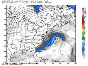
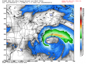
It will stay relatively quiet and cool in Southern New England right into the weekend. With a strong area of high pressure to our north, and a slow-developing storm off the Southeastern United States coast, the wind will continue to be out of the east-northeast into next week. Highs will be in the 40s, and lows will be in the upper 20s to low 30s Wednesday through Saturday morning. Skies look partly cloudy to mainly clear, but we’ll have too keep a close eye on any low clouds that develop to a northeast with that persistent wind direction. The high temperature on Saturday and Sunday will be close to 50 degrees, and the east-northeast breeze will remain active.
Nor’easter possible next week

At this point, we are fairly confident that the slow-cooking storm off the Southeast coast will drift to the north in the early to middle part of next week. It’s still somewhat unclear what the main impact will be from the storm, and the most likely impact is a continued east-northeast wind that brings in battering waves to an already damaged Mid-Atlantic and New England coast. Southern New England will likely see some precipitation, either chilly rain, wet snow, or both, but it is too early to say if it will be the heavy stuff or just a fringe impact if the storm stays a bit farther out to sea. It’s a situation worth monitoring if you have travel plans prior to the Thanksgiving holiday.
Cover photo courtesy of http://02809photo.com


