
It will be a damp and dreary start to the week in Southern New England. Occasional drizzle, mist and a few light showers will last through the day with temperatures in the low to mid 40s. A developing storm will bring steadier rain Monday night into Tuesday morning. The temperature will rise overnight, and it may reach the low 50s by early Tuesday. Rain is likely Tuesday morning, but it may taper to showers during the afternoon. The temperature will rise into the low to mid 50s around midday before tumbling through the 40s in the afternoon and evening.
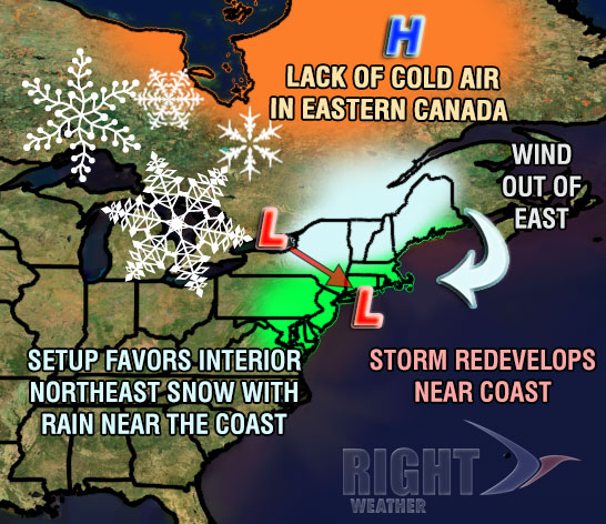
The storm may be close enough to bring a few snow showers to Eastern MA on Wednesday. RI is likely to to see partly to mostly cloudy skies. It will be brisk and chilly, with highs in the low 40s. Thursday should be a relatively quiet day. Highs will be in the 40s as clouds increase during the afternoon. Another storm will bring rain and milder temperatures Thursday night into Friday. The temperature will likely climb into the upper 40s to low 50s again ahead of the approaching system. Rain is possible Friday morning before drier air moves in during the afternoon. The early outlook for next weekend is for blustery colder conditions. There is a possibility that the storm slows its departure and continues to bring snow showers Saturday and Sunday. Highs will likely be in the 30s both days. The weather pattern will likely stay active with additional storms possible after Christmas and before the New Year.
Cover photo by http://02809photo.com


