The Friday morning computer model trend is for an inside runner (storm that moves on the coast or inland) on Tuesday, followed by the potential for some backlash snow on Wednesday as the storm departs. If you’re a snow-lover, the terms “inside runner” and “backlash” are not exactly what you want to hear for accumulating snow in Southern New England. An inside runner will bring nothing but rain, and backlash snow, in the absence of a nice Norlun trough, it always a dicey proposition and usually doesn’t amount to much.
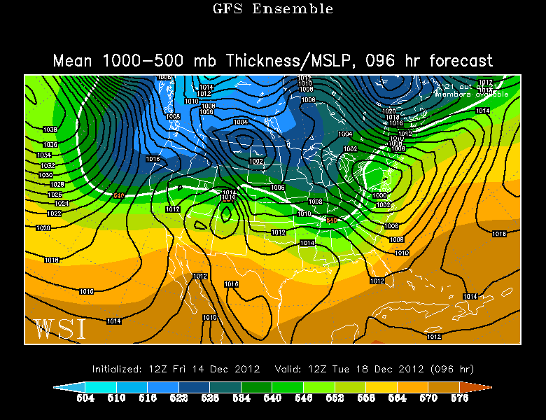
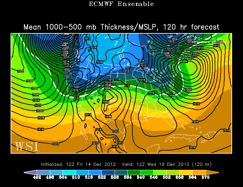
There is great agreement among the GFS (Fig 1&3) and ECMWF (Fig 2&4) ensembles through 120 hours. Both ensemble means are a little colder than the operational runs, but still warm enough for rain instead of snow in all of Southern New England. Based on that track, Maine stands the best chance of getting heavy, accumulating snow between Sunday and Wednesday.
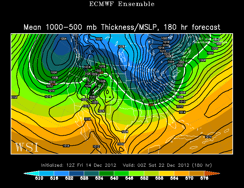
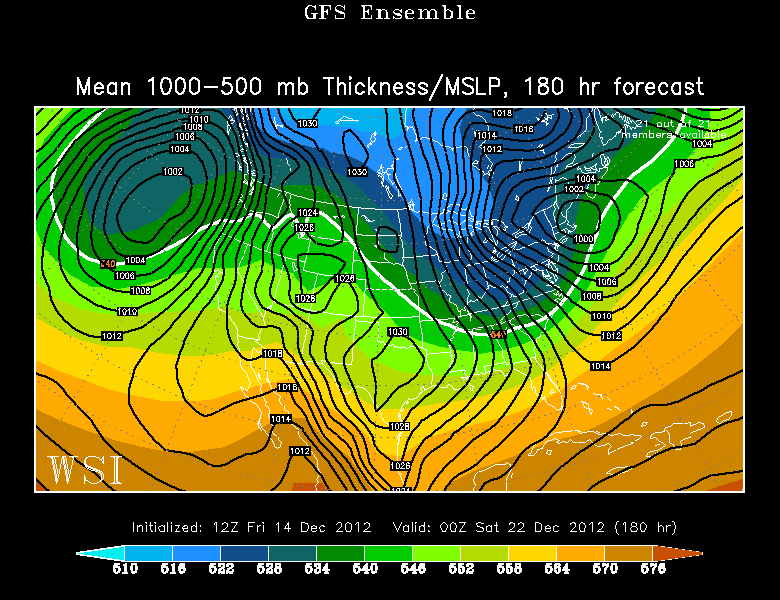
There should be a break in the action on Thursday before an Alberta Clipper moves through the Midwest, takes on a negative tilt, and redevelops near the coast. The GFS (Fig 5) Ensemble has the secondary forming near Cape Cod – way too close for any snow in Southern New England. The ECMWF (Fig 6) is pretty similar, with a storm too close to the coast for snow in the I-95 corridor. Once again, this track means big snow for the mountains of Northern New England – particularly in Maine.
A few notes based on today’s trends:
- Sunday storm brings a touch of snow with a quick change to rain as expected for most of RI and SE MA
- Wet and raw at Gillette Stadium for the Patriots-49ers game
- Damp most of Monday, then steadier rain Monday night into Tuesday
- Colder with the chance of backlash snow on Tuesday night into Wednesday
- Another storm likely next Fri/Sat – right now, it looks too warm for snow in Southern New England
- Pattern stays chilly and active in the east through Christmas week
- We are close to a pattern that would bring several snow events to Southern New England, but we’re not quite there yet
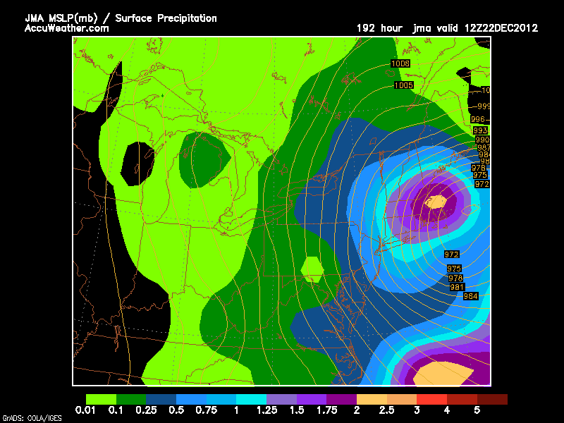
- If you’re looking for hope that next Fri/Sat may be snow instead of rain, look no further than the JMA (Japanese) model (Figure 7)
- The jackpot for snow in the next 7-10 days will be the mountains of Northern New England – great news for skiers!
- Don’t give up hope for a white Christmas in Southern New England – it will be cold enough for snow in the last few days leading up to Christmas day
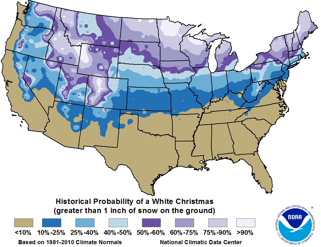
- A white Christmas is looking very good from the Berkshires through all of Northern New England, but, historically, that’s been true (Figure 8)