This is all a moot point if the world ends at 6:12 am Friday morning, but here goes, anyway…
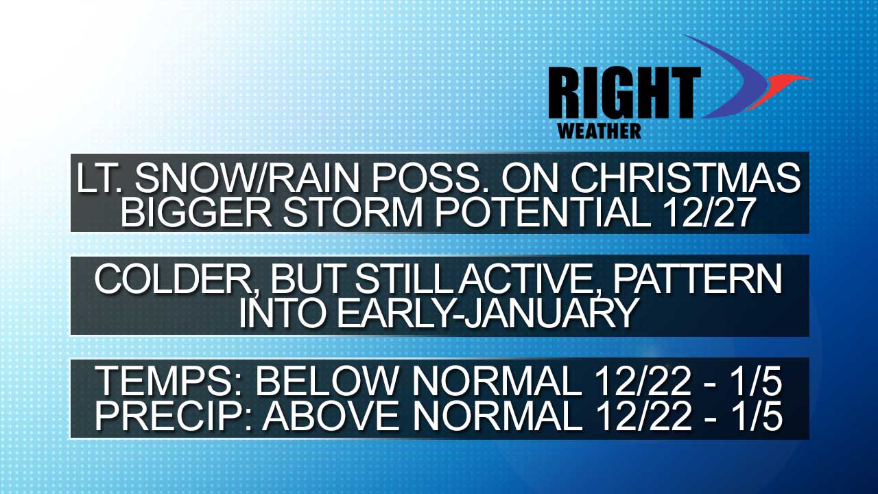
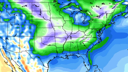
The colder weather pattern has been slower to develop than many models, and I, predicted, but it still looks like it is very much going to happen in the next couple of weeks – particularly from shortly after Christmas through the first week of January. The predominant storm track is slowly shifting east, and a storm after Christmas around the 27th may bring the first significant accumulating snow of the season to the coast of the Mid-Atlantic and the Northeast. The computer models are all over the place on the exact track of the storm, with some sending it out to sea south of Southern New England, and others tracking it to the west of Southern New England, bringing, yet another, rain storm. I think the answer lies somewhere in the middle, but we’ll get a better read on it over the weekend. Regardless of the track of that system, it appears some Arctic air is likely to begin heading south into the United States for the end of December and early January. Not only will it turn considerably colder, it’s most likely going to turn colder than normal. It’s possible we could keep the active storm track and stir up a Nor’easter in that timeframe, but it’s too early to get in those kind of specifics. Check the video for more details on the next two weeks.