The large storm responsible for some wild weather in the Midwest and South has arrived in New England. Snow was breaking out in CT by sunset, and the first flakes reached SW RI shortly after 6pm. The snow will continue to move through RI and MA during the evening. The initial burst of snow is rather heavy, and roads may quickly become snow-covered.
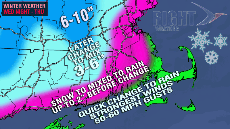
Accumulations will be limited from the coast to the I-95 corridor. Nevertheless, a quick couple of inches could lead to some treacherous travel on any untreated roads. A transition from snow to mix to rain should occur between 9pm and midnight from the coast to the I-95 corridor.
Farther inland, the snow will hang on for a couple of hours longer, and that, combined with heavy precipitation, will likely lead to several inches of snow. Most of NW RI, especially the hills, will receive at least three inches of snow, and some may get a quick 6″ before the change. The change to a mix should occur between midnight and 2am.

The wind will increase throughout the evening. Peak gusts are likely in RI between midnight and 6am, and between 3am-9am in SE MA. The strongest gusts near the coast should be over 50 mph, with some 60 mph gusts possible.
The heaviest rain should end by mid-morning Thursday. The afternoon will be mostly cloudy with a few passing showers. The temperature will briefly rise into the 40s from the coast to I-95 before falling late in the day. It will be in the upper 30s to low 40s inland.


