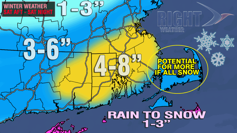
Most RI and SE MA are in a Winter Storm Warning through this evening. Just about all of the rest of Southern New England is in a Winter Weather Advisory. Snow totals are likely to be between 6-8″ in many spots. The accumulation map may be updated to raise the lower end in the areas shaded in tan.

Cape Cod and the islands will receive the heaviest precipitation and strongest winds from the storm as it passes southeast of Nantucket. There should be just enough mild air for some of the precipitation to be rain, and that will help to keep snow totals down. Some wind gusts to 50 mph are possible on the outer Cape and Nantucket late this evening or just after midnight.
Sunday looks partly cloudy, blustery, and cold. The temperature will stay in the 20s, with wind chills ranging from the high single digits to the teens. It looks like a very chilly evening for football at Gillette Stadium.
The temperature will tumble to 10-15° by early Monday morning, before moderating a bit to ring in the New Year Monday night. A weak system could produce some snow showers or light snow Monday night into Tuesday. A stronger surge of Arctic air is likely later in the week. The forecast low temperature are almost too low to print! Some may be near 0° at some point between Thursday and Saturday.


