The following graphics show the odds of reaching certain snow amounts in the Providence Metro area (and I-95 corridor in SNE except in Washington County) during the wintry storm Wednesday night into Thursday. All of the snow will fall Wednesday evening, with a change to sleet and rain likely by midnight.
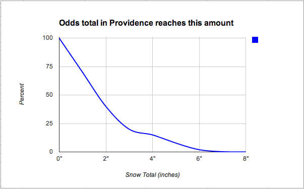
By looking at this first image you can see that it is nearly certain that the precipitation will start as snow and some will accumulate. Because the graph slopes sharply down to the right, it is an indication that this storm does not have much potential to be a big snowstorm for the I-95 corridor. As we know, there will be a burst of snow/sleet before the rain. Breaking down the numbers, there is a 70% chance of 1″ of snow, 40% chance of 2″, less than 25% of 3″, and so on.
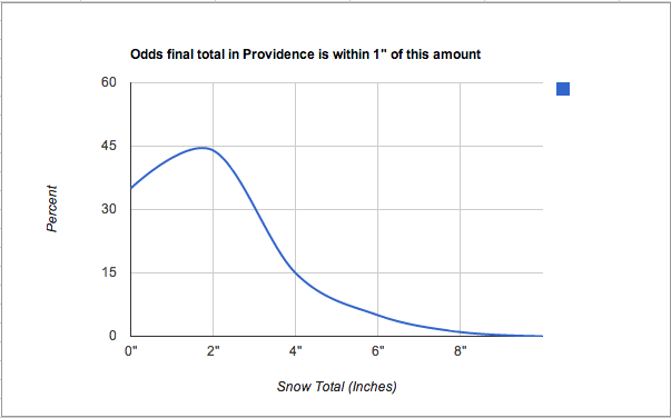
This graph shows how likely a less than 4″ snowfall is in the Providence area. There is only a 15% chance of seeing more than 4″ of snow before a change to rain.


