
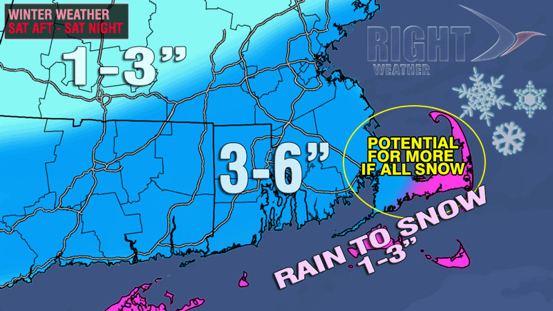
Based on the current forecast track of the storm, the final snow totals will not be huge for most of the area, but roads will need to be treated and cleared, and you’ll probably have to shovel your driveway. If the storm tracks 50 miles farther northwest and/or moves just a bit slower, then the snowfall totals will nearly double throughout the entire area. That scenario is still possible.
The weather behind the departing storm will be blustery and very cold on Sunday. Highs will be in the mid to upper 20s, and the wind chill will be in the teens. The sky will become partly sunny. It will be mainly clear and bitter cold Sunday night. Lows will be in the teens on Monday morning.
Cold start to the New Year
Right now, it looks like there will be some chilly weather to ring in the New Year in the Northeast. The high on Monday will be in the low 30s, and the temperature at midnight will be in the 20s. Polar bears and penguins will have temperatures in the 20s, with a fresh westerly breeze for their plunges on New Year’s morning. An Arctic cold front will move through Tuesday or Wednesday, bringing in the coldest air of season as the kids head back to school for the rest of the week. When the Arctic air hits, lows will be in the single digits, and highs will only be in the teens/20s. The weather should stay mainly dry through the end of the week.
[/signoff]


