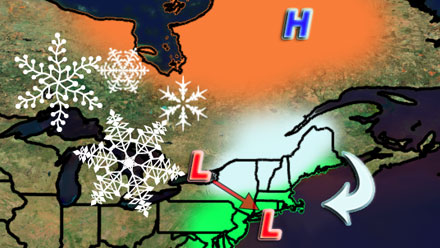
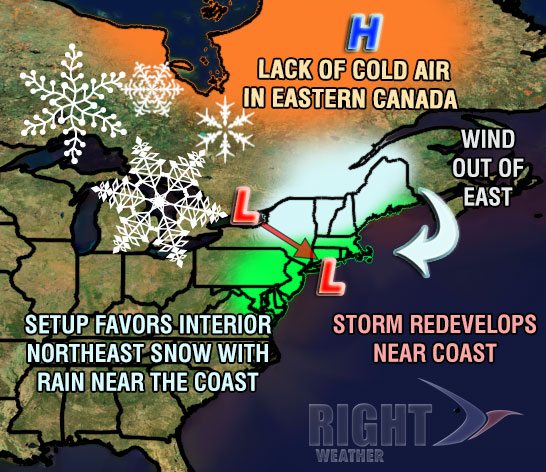
The weather pattern is shifting from benign and mild to slightly cooler and stormy, with the predominant storm track strongly favoring rain instead of snow in Southern New England. Some chilly rain is likely Sunday evening and night as a storm moves out to sea south of Southern New England. The temperature will generally be in the mid to upper 30s inland, and low 40s near the coast. The weather looks raw and wet at Gillette Stadium for the Patriots-49ers game Sunday evening.
Monday looks damp and dreary, with light rain showers, drizzle and mist, and temps in the low to mid 40s. A developing storm will move over Southern New England Tuesday night, bringing some steady rain and rising temperatures. The heaviest rain is likely late at night, and the temperature will climb from the 40s into the low to mid 50s near the coast by early Tuesday morning.
Steady rain will end by mid to late morning on Tuesday, and an increasing west-northwest wind will bring in some cooler, drier air Tuesday night. High temperatures on Tuesday will be in the low to mid 50s – more than 10 degrees warmer than normal for mid-December. The weather looks fairly quiet Wednesday and most of Thursday. It will be brisk and chilly Wednesday. The wind will relax on Thursday, with clouds increasing by late in the day.
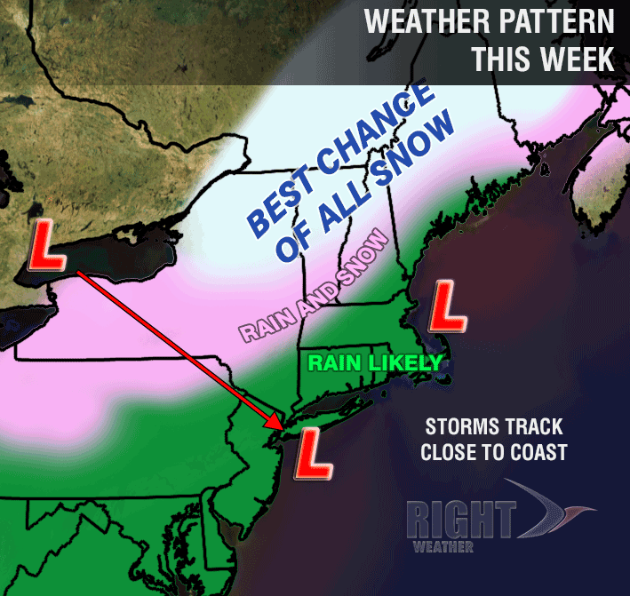
Rain showers and very mild air return Thursday night into Friday morning as a storm moves through the Great Lakes into Eastern Canada. All of Southern New England will be on the mild side of the storm, and an increasing south-southeasterly wind may get the temperature into the low to mid 50s again. Rain should end Friday morning, and the storm will strengthen in Eastern Canada allowing for a cold plunge with gusty winds through the weekend in New England. Once again, a strong west or northwesterly wind is not going to bring steady snow to Southern New England. A few flurries are possible, but, at this point, a white Christmas is looking like more of a long shot than normal with the next storm not expected until after Christmas. High temperatures next weekend may not make it out of the 30s, with wind chills in the 20s.


