The weather will be fairly quiet in the Northeast on Thursday ahead of the next weather system which will be bringing blizzard conditions to the Midwest. Clouds will gradually increase in Southern New England Thursday, with the temperature rising from a low in the 20s to the upper 30s to low 40s by early in the afternoon. It will remain mostly cloudy for most of Thursday night, and the temperature will rise from the 30s late in the evening, to the low to mid 40s by early Friday.
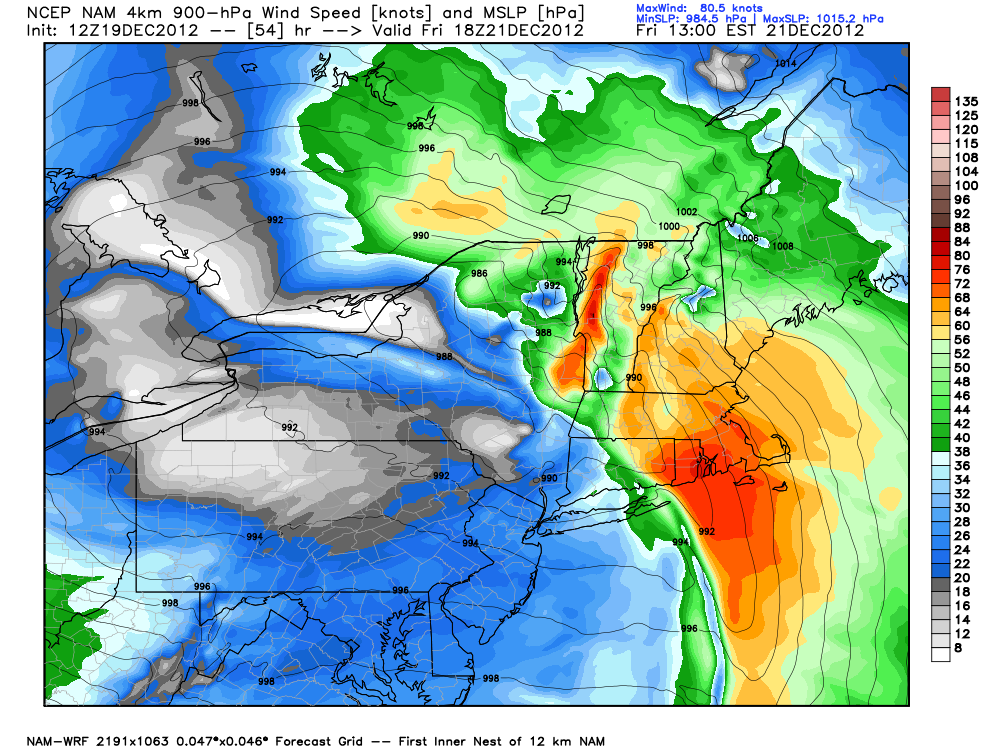
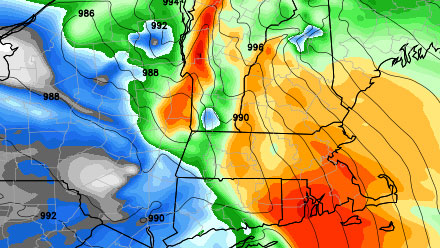
Friday looks like a wet and wild day in Southern New England. The vigorous system will cut west of New England, putting CT, RI, and MA on the mild side of it. Some heavy showers and strong winds are likely through midday Friday. The strongest winds will be near the coast where some 50 mph gusts are possible. The temperature will rise into the low 50s in response to the strong south-southeasterly winds. Some minor coastal flooding may occur at the RI coast near the time of high tide around midday. The cold front will move through early in the afternoon, and colder, drier air will start to wrap in behind the storm Friday evening. Some snow showers are possible in the high terrain of Worcester County.
The weather will be somewhat unsettled this weekend as the upper-air disturbance slowly moves over New England. You can expect blustery, colder conditions, with scattered snow showers and flurries. At this point, it looks like there will not be any significant accumulation of snow. The wind will be very gusty, and the daytime temperatures will be in the 30s. As a result, the wind chills will be in the 20s during the day and teens at night.
Renewed hope for a white Christmas
Just when it looked like all hope for a white Christmas in Southeastern New England was lost, a fast-moving disturbance is now being projected by some computer models to move through the Mid-Atlantic and Southern New England on Christmas Eve and/or Christmas morning. There is the possibility, especially inland, of seeing enough light snow to leave the ground covered in white by Christmas morning. The appearance of this subtle disturbance is a new development among the latest computer models, and we’ll be monitoring it closely in the coming days. Christmas day should become partly sunny, with highs in the upper 30s.
Another large storm system is likely to have an impact in the Eastern United states between Wednesday and Friday of next week. A tentative timeline has the brunt of it in New England occurring Wednesday night and Thursday. Once again, the long range computer models are favoring rain instead of snow, especially for the I-95 corridor. Right now, it is way too early to talk about details with that system, and a slight shift in the jet stream could bring a more wintry scenario into Southern New England.


