This week will get off to a cool start, but the overall theme of the week will be a January thaw that has temperatures well into the 40s for several days in Southeastern New England. A cold front will move through late Sunday night, and the wind will shift to the north-northwest Monday morning. It will not be terribly cold Monday morning, with temperatures in the upper 20s to low 30s. Monday afternoon will be sunny, brisk, and cool, with highs in the low to mid 30s.
The cool weather will not be staying for long, as the wind shifts to the west-southwest by early Tuesday, and milder weather quickly moves into the Northeast. Tuesday afternoon will be partly sunny with highs in the low to mid 40s. Wednesday may be even milder, with a westerly breeze and highs in the mid 40s. Another weak cold front will sneak through Wednesday night, but the air that is behind the front will not be that much colder than what is out ahead of it, so highs will be in the 40s again on Thursday. All the while, the weather will stay dry.
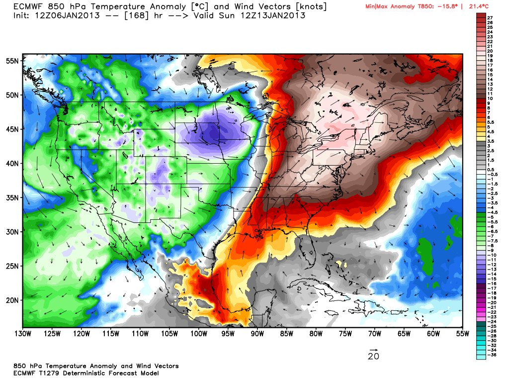
The January thaw continues into next weekend. The next chance of some precipitation in Southern New England is Friday into Saturday, and, right now, it looks like rain showers with temperatures in the 40s. The peak of the warm-up may occur Saturday and Sunday as a storm moving through the Midwest brings the wind in Southern New England to the southwest, and the temperature jumps into the upper 40s to mid 50s. The timing and strength of that weather system is still questionable, and big mid-January warm-ups aren’t always a sure thing even when the computer models are predicting them 5-7 days in advance.


