
Chilly sunshine ruled the sky for most of Southern New England on Saturday. The temperature topped out near 30° – about 8° colder than normal for early-February. Even with the chilly weather, the world’s most famous groundhog Punxsutawney Phil made a prediction of an early spring on Saturday morning. I guess that is notable because 85% of the time Phil sees his shadow and predicts six more weeks of winter. While an early spring is possible, it won’t be coming in the next week! The temperature will be at or below normal in Southern New England for most of the first full week of February.
Touch of snow Saturday night through Sunday night
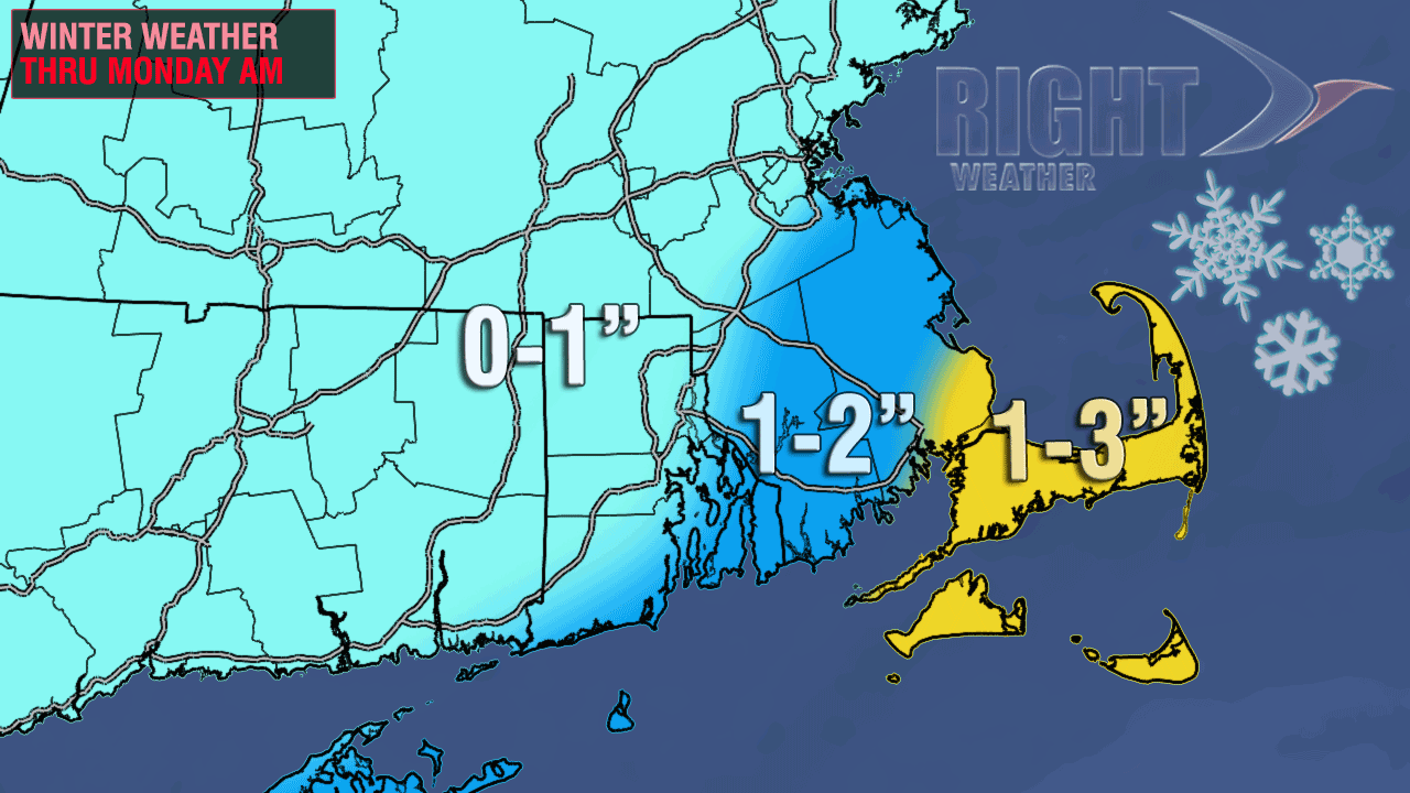
A weak disturbance will move south of Southern New England Saturday night. Some snow showers or a period of light snow are possible at night, with the best chance of seeing a couple of hours of steady light snow near the coast. That disturbance will eventually strengthen into a significant storm, but it will not happen until it is reaching the Canadian Maritimes. As the storm moves north in the Atlantic Ocean on Sunday, some snow showers or flurries are likely – especially in Eastern Massachusetts. In a worst-case scenario Cape Cod and the islands may pick up about 3″ of snow between Saturday night and Monday morning. In Rhode Island, the most likely scenario is for a dusting to an inch, with outside chance of 2″ near the coast. The temperature will be in the upper 20s to low 30s on Sunday afternoon.
Chilly week ahead
Any light snow should end by Monday morning, and it will be sunny and cool Monday afternoon. The high temperature will be in the upper 20s to low 30s again. Monday night looks clear and cold. Lows will be in the teens. Another Alberta Clipper will make a run at Southern New England in the midweek. Once again, it does not look like it will amount to much. Tuesday should see a gradual increase in late-day clouds, with highs generally in the upper 20s. Wednesday looks mostly cloudy with scattered snow showers. Highs will be in the low 30s on Wednesday.
One more system is in the forecast for late this week. Right now, it looks like it has the most potential for the I-95 corridor to bring a minor snowfall. The track of the late-week system is in question, and if it heads too far north then there may be some mixed precipitation or rain near the coast. We will keep an eye on the situation since these fast-moving systems can bring a narrow swath of moderate snow as they move quickly from west to east. For the most part, it looks like that swath will not occur in Southern New England this week.


