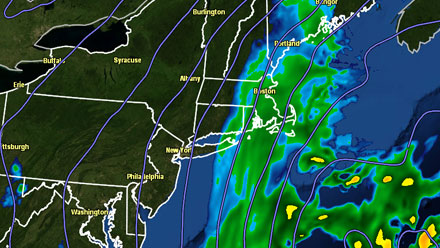
A cold front moving through Southern New England Sunday morning will combine with a developing storm off the Carolina coast to bring a period of snow to RI, CT, and E MA Saturday night into Sunday. There are still some questions about the westward extent of the steady snow as the storm moves north and passes east of Cape Cod Sunday morning. The safest bet for several inches of snow is on Cape Cod and the islands, with a reasonably high likelihood of snow in E CT, RI, and interior SE MA. The National Weather Service has issued a Winter Weather Advisory and Winter Storm Warning for parts of Southern New England.
After a burst of snow showers with the cold front in some places Saturday morning, a widespread light to moderate snow should develop late in the day or during the evening. The snow will continue overnight, steadiest in SE MA.The wind will increase to 30-40 mph on Cape Cod and Nantucket overnight. There will likely be some higher gusts. Wind will reach 15-30 mph in RI and interior SE MA, with some higher gusts likely by dawn Sunday. The temperature will be dropping into the teens to mid 20s overnight, leading to a fluffy snow, which should limit the potential for any power outages.
Sunday looks blustery and cold, with snow continuing through the morning. Once again, the snow will be steadiest in SE MA. Temperatures will hover in the upper teens to mid 20s, and it will feel colder because of the gusty north-northwesterly wind which will hang around all day. Snow will taper off from west to east Sunday afternoon as the storm moves north into the Canadian Maritimes.
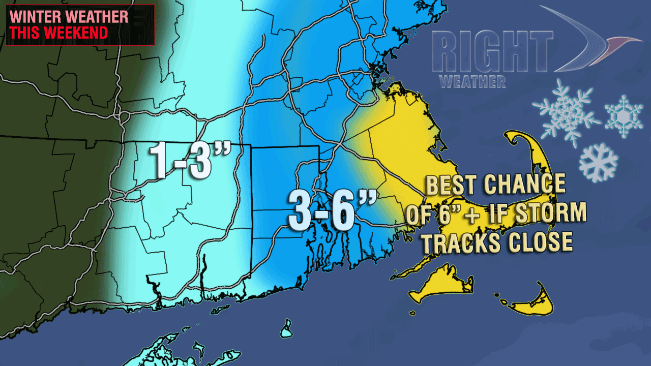
It is an extremely difficult snow accumulation forecast because there is still the possibility that the storm travels far enough east that the only significant accumulating snow occurs on Cape Cod and Nantucket. At this point, we still believe that he Providence area will be on the western edge of the storm, with our forecast allowing for about 3-4″ of snow to accumulate before the storm ends. The totals increase to 4-6″ in SE MA, and the chance of 6″+ on Cape Cod and the islands.
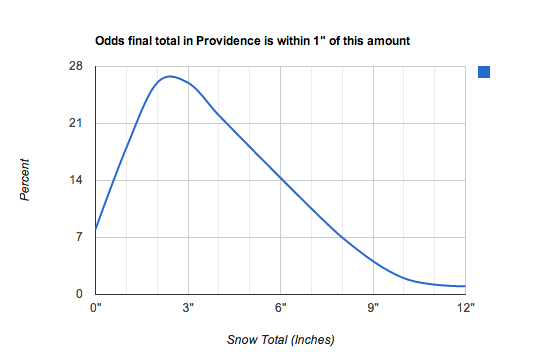
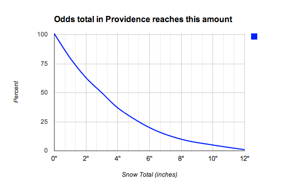
The snow odds forecast for the Providence area has the most likely final total within 1″ of 2.7″, and the odds of reaching 3″ at about 50%.
It will stay cold in Southern New England into early next week. The low temperature will be in the low to mid teens Monday morning, and the high temperature will struggle to get out of the 20s, even with a fair amount of sunshine. Some light mixed precipitation or rain is possible late Tuesday.


