For the latest updates on the potential blizzard, please check the Live Blog.
The potentially paralyzing blizzard of 2013 was already taking shape over the Mid-Atlantic states on Thursday night. It will move north toward Southern New England before turning east and passing south of Nantucket on Friday night. The storm will slow near Nantucket and may wobble a bit before heading out to sea late Saturday. The conditions are ripe for an epic snow storm in Southern New England. Winds will likely gust to hurricane force near the coast, and snowfall rates of 2-3″ per hour are possible. Some of the snow bands may be so intense that thunder and lightning occur Friday night.
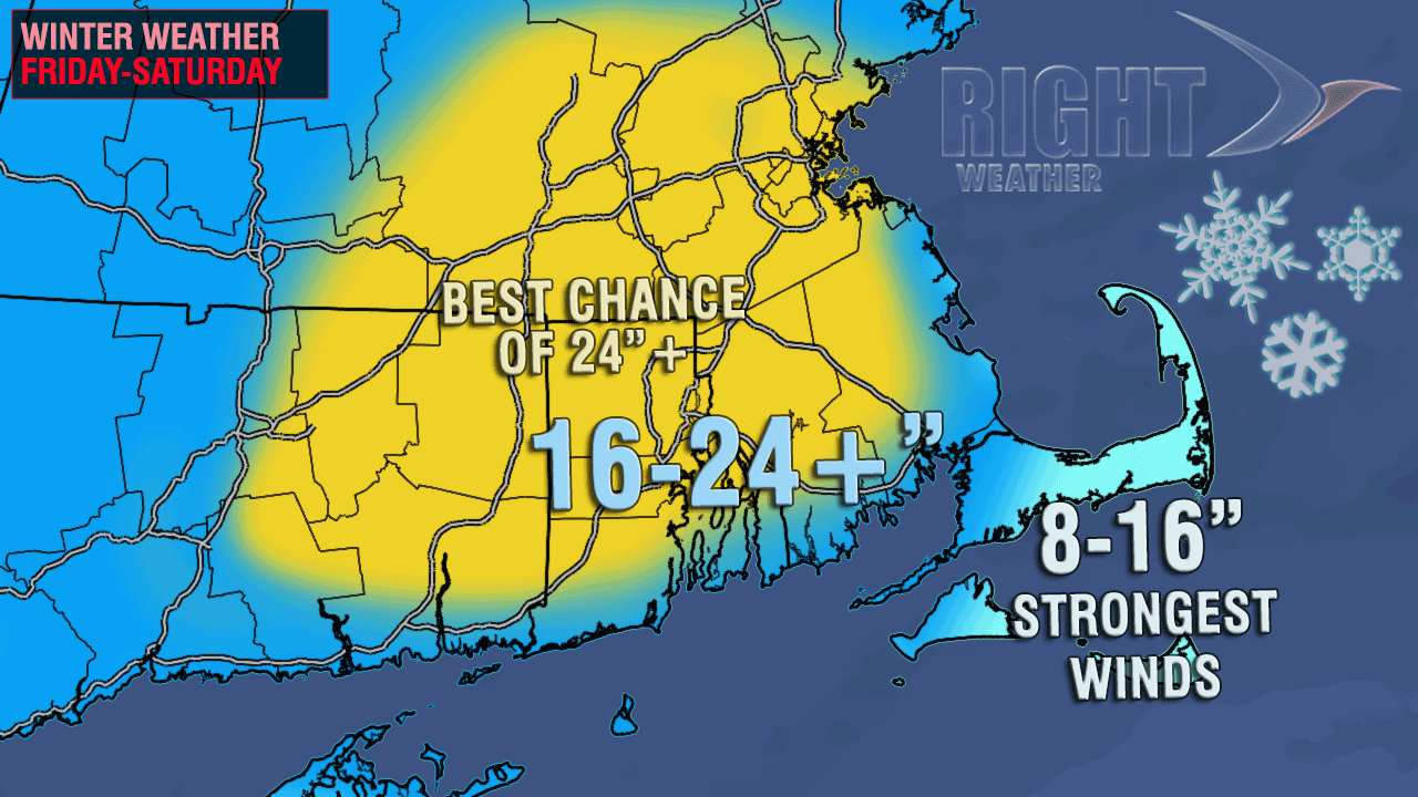
The combination of a very intense, slow-moving storm with a copious moisture feed from the tropics means that most of Southern New England will see one of the all-time great snowstorms in the past 100+ years. 18″ final totals will be widespread, and some places may top 2 feet! The snow will be wind-driven and difficult to measure. Drifts of five feet or more may occur. Power outages are likely due to the combination of strong winds and very heavy snow.
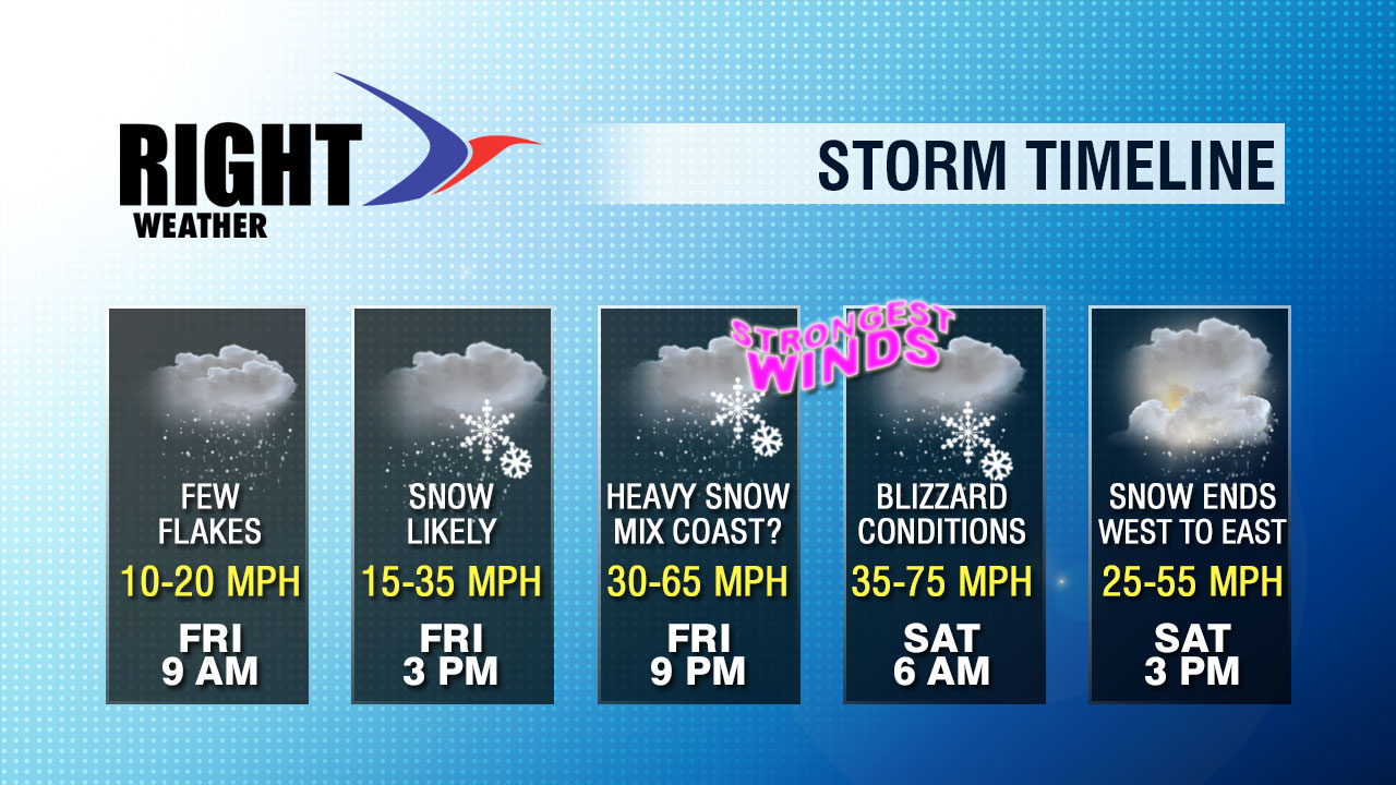
Snow will develop by late Friday morning, and it will get heavy by mid to late Friday afternoon. The heaviest snow in RI is likely to occur between sunset Friday and sunrise Saturday. 16-20″ of snow could fall in that roughly 12 hour period.
It appears the only chance for a prolonged period of mixed precipitation or rain is on Cape Cod and the islands Friday afternoon and evening. Even in those areas, the backlash snow late Friday night into Saturday should pile up to about a foot. Initially, the temperature will be marginal for snow in all of Southern New England, with highs on Friday in the low to mid 30s. As the storm progresses, and particularly by late Friday evening, colder air will start to wrap into the storm. That will drop the temperature into the 20s near the coast, and possibly all the way into the teens inland by dawn on Saturday. The temperature will not warm much at all during the day Saturday.

The strongest winds from the storm will occur Friday night into Saturday morning, but it will be windy near the coast by mid to late afternoon Friday, and it will stay windy near the coast into Sunday night. The temperature will drop into the single digits Sunday night as skies clear.


