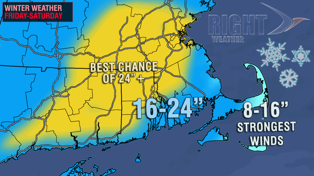
 Southern New England was really getting into the thick of Nor’easter that is likely to produce blizzard conditions Friday night as it wallops CT, RI and MA. Heavy snow bands spinning in off the Atlantic Ocean will continue to bring 1″+ per hour snowfall for many places overnight. The wind will continue to increase and peak tonight between 35-60 mph inland, and 45-75 mph near the coast. The highest 70+ mph gusts are likely on the Cape and islands.
It looks like a mainly snow event for most of Southern New England. The exception may be on Lower Cape Cod and Nantucket where rain could occur for a time. Even there, the snow totals will be impressive. Final totals should be high enough to put this storm in the top-5 since 1905 in Providence, RI. It may challenge the Blizzard of ’78 for the top spot.
The heaviest snow will end around dawn in RI, and by mid to late in the morning in SE MA. Snow showers should wind down by midday in RI, and by late tomorrow afternoon in far E MA. The wind will continue to howl tomorrow, with frequent gusts over 45 mph. The temperature will tumble from the 30s to the low 20s tonight, and that will change any wet, heavy snow to a drier, fluffy variety that will be blown around leading to large snow drifts by dawn. 5 foot plus snow drifts are possible in the hardest hit areas.
Moderate to major coastal flooding will occur at the time of high tide Friday night and Saturday on eastern facing shore lines in Massachusetts. Minor, splashover flooding is possible around Narragansett Bay. Check out the interactive Coastal Flood Warning Map on rightweather.net.
You can get the most detailed information on the storm’s development on the Live Blog for Right Weather Pro members.


