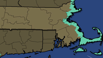
The slow-moving Nor’easter/Blizzard that will hit Southern New England will be bringing more than just snow and wind to Southern New England. The persistent northeast wind combined with the intense storm and astronomical high tides will lead to coastal flooding in Eastern Massachusetts. East-facing shorelines are most susceptible to minor to major flooding at the time of high tide – particularly Saturday morning. Check the interactive map below for the latest from the National Weather Service on the coastal flood threat in your area.

![]()
[google-map-v3 width=”600″ height=”600″ zoom=”12″ maptype=”roadmap” mapalign=”center” directionhint=”false” language=”default” poweredby=”false” maptypecontrol=”true” pancontrol=”true” zoomcontrol=”true” scalecontrol=”true” streetviewcontrol=”true” scrollwheelcontrol=”false” draggable=”true” tiltfourtyfive=”false” addmarkermashupbubble=”false” addmarkermashupbubble=”false” kml=”http://www.erh.noaa.gov/box/coastHazardOutlineAsKML.php?outputType=kml&displayType=GE” bubbleautopan=”true” showbike=”false” showtraffic=”false” showpanoramio=”false”]


