Winter settled back in to Southern New England for the start of February on Friday. The high temperature barely eclipsed 32° in many spots, and clouds made it feel a bit cooler than that. The clouds came courtesy of a small storm system that brought up to 6″ of snow to the southern part of New Jersey early Thursday night through Friday morning. This fast-moving Alberta Clipper will be similar to several others that move from the Upper Midwest to the Mid-Atlantic and Northeast in the next week.
Friday night will be partly cloudy to mainly clear and cold. The temperature will drop into the mid teens inland, and low 20s near the coast and in the cities. Saturday will be another dry, chilly day. The high temperature most likely will not make it above freezing as clouds increase in the afternoon. A few flurries or light snow showers are possible Saturday night into Sunday morning. The temperature will fall into the upper teens to mid 20s Saturday night.
A developing storm will brush by Eastern New England Sunday afternoon into Sunday night. Right now, it does not look like it will come together enough for an appreciable snowfall, but some light snow is possible – primarily Sunday afternoon and night. The storm will intensify and become a big snow/wind maker for the Canadian Maritimes on Monday, but it that will not happen in New England. The best chance of seeing a minor accumulation this weekend is in RI and SE MA, where 1-2″ may accumulate between Saturday night and Monday morning. Check rightweather.net for a detailed accumulation map Saturday morning, if warranted.
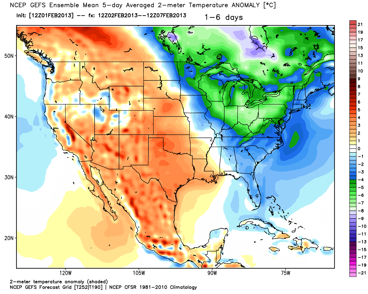
The theme for next week will be colder than normal weather in the Northeast. The temperature will stay in the 20s and 30s during the day, and fall into the teens to low 20s at night. Monday and Tuesday look dry, with the chance of some light snow Wednesday as another Alberta Clipper passes south of Southern New England and struggles to get organized enough to deliver steady snow. At this point, the threat of steady snow on Wednesday is fairly low. Another system will approach late in the week, and the long range projections call for some snow moving through New England Friday into Saturday.


