Every now and then we get locked into a weather pattern where the storms are evenly spaced and consistent for a few weeks. Right now, it seems Southern New England is in a pattern that threatens the area with snow every weekend. There have been blizzards (one big, one smaller) on two consecutive weekends, and most computer models are honing in on another storm threat for this coming weekend.
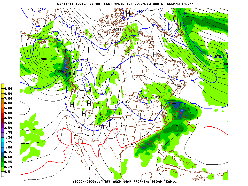
GFS (Global Forecast System)
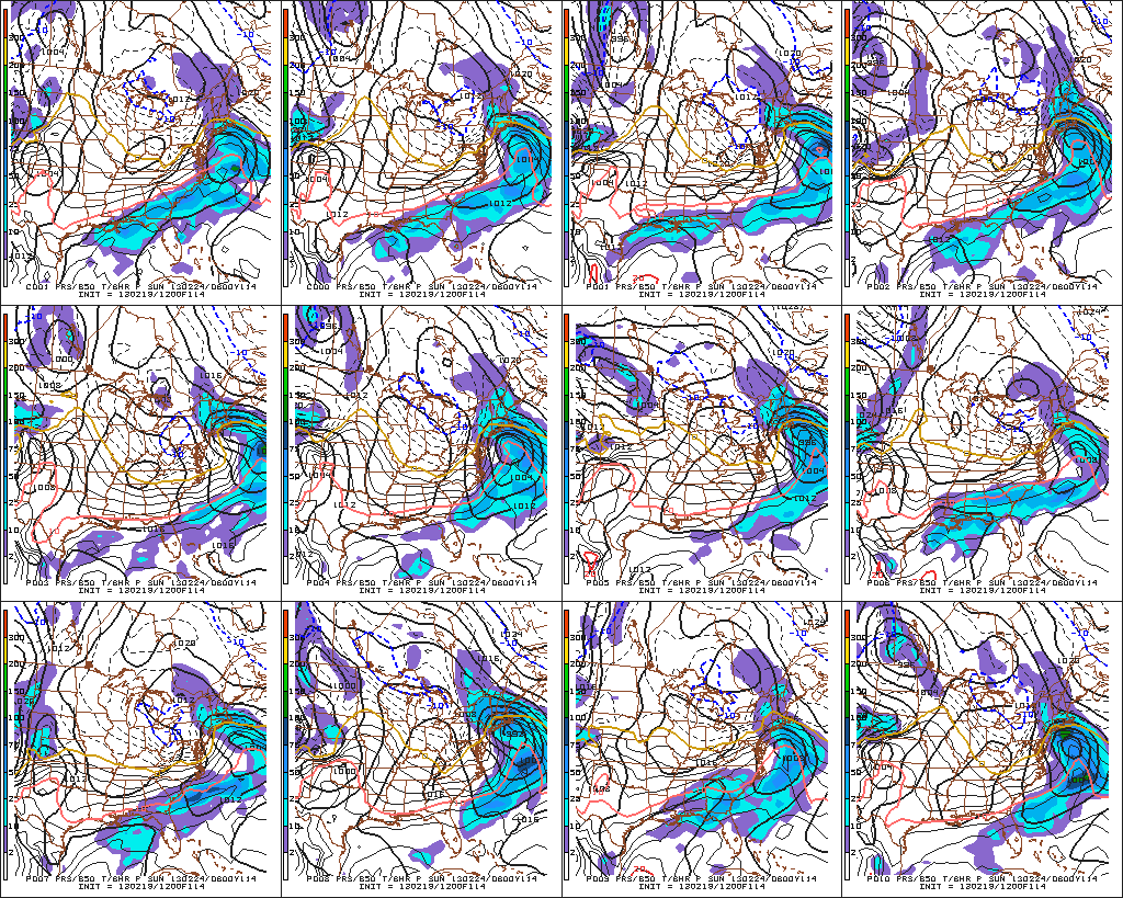
The 12Z (7am) run of the GFS brings a storm to Southern New England Saturday night into Sunday. The combination of the track and limited cold air supply means rain or a mix from the coast to Providence, with snow/mix further inland. I think it’s too early to focus on the particulars of the GFS solution, and rather we should just focus on the fact that it develops a storm. Climatologically, in late-February, with the forecast track, there should be enough cold air around for mainly wintry precipitation inland in Southern New England. The operational GFS model has been indicating minor-moderate storm for several runs, and, now, nearly all the ensemble members agree, although precipitation-type is an issue for most.

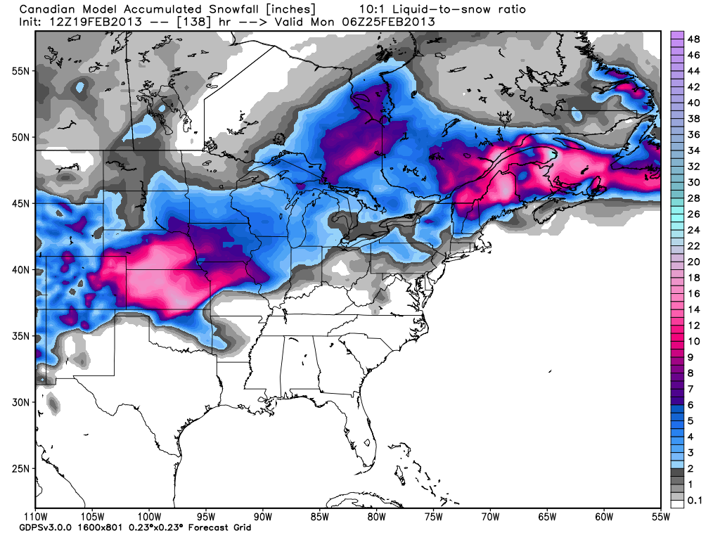
Canadian (GEM)
The Canadian model also has a minor-moderate storm with limited cold air and mainly rain over Southeastern New England. Overall, it looks similar to the GFS.
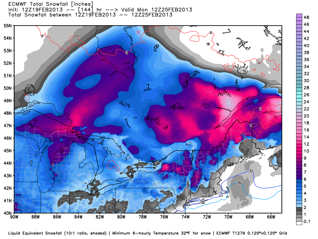
European (ECMWF)
The European model has a slower developing system that brings snow/rain to Southern New England Saturday night and Sunday. The evolution of the ECMWF solution indicates a Norlun trough hanging behind the storm as it departs late Sunday. That may be enough for a transition from rain to snow in most areas. It is not a big storm, and the areas that see all snow would be looking at 4-6″.
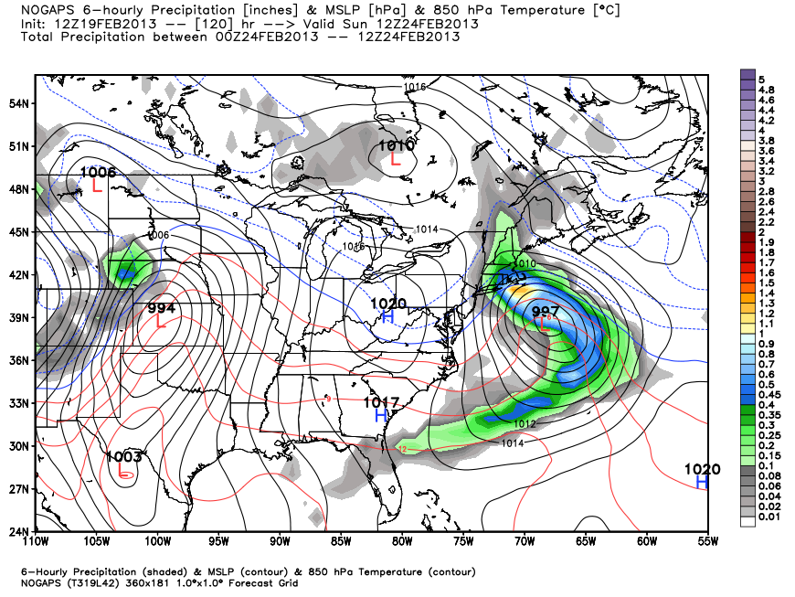
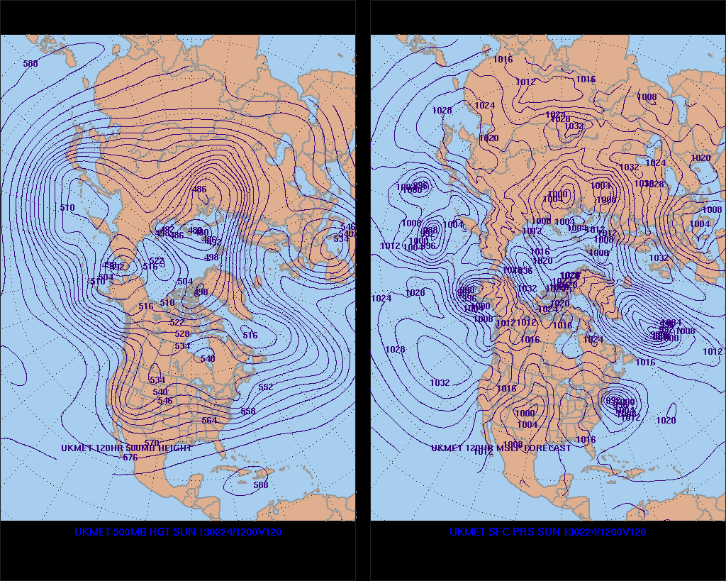
JMA/NOGAPS/UKMET
A few other models also indicate the same storm potential that most of the rest of the guidance is suggesting. A storm that come close enough to bring steady precipitation, with uncertainty about snow/rain because of the proximity of the storm, position of high pressure to our northeast, and an easterly wind direction bringing in some milder air.

The bottom line is it looks like we’ll have another storm to deal with this weekend, but, right now, it does not look like an exclusively snow scenario for most of CT, RI, and MA. Given the time of the year, if it does develop just far enough south to throw the wind around to the northeast, instead of east or east-northeast, that would favor snow. At this point, the consensus forecast is for a track a bit farther north that brings rain/mix into play. We’ll evaluate the computer models again Wednesday in another update.


