The storm this weekend will not be as snowy as the SNE blizzard two weeks ago or as windy as the E MA blizzard last week, but it still has the potential to be headache for many in Southern New England as it passes by late Saturday into early Sunday. Rain will be a factor near the coast, but moderate to heavy wet snow will be the predominant precipitation type inland – the question is how far inland the rain/snow like will set up.
Feel free to ask any questions in the comment section at the end of the blog. Click to enlarge all images.
A few things:
12Z run = 7 am EST initialization time
00Z run = 7 pm EST initialization time
QPF = Quantitative Precipitation Forecast (how much liquid precipitation falls – must convert for snow totals)

12Z NAM (North American Model)
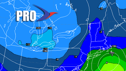
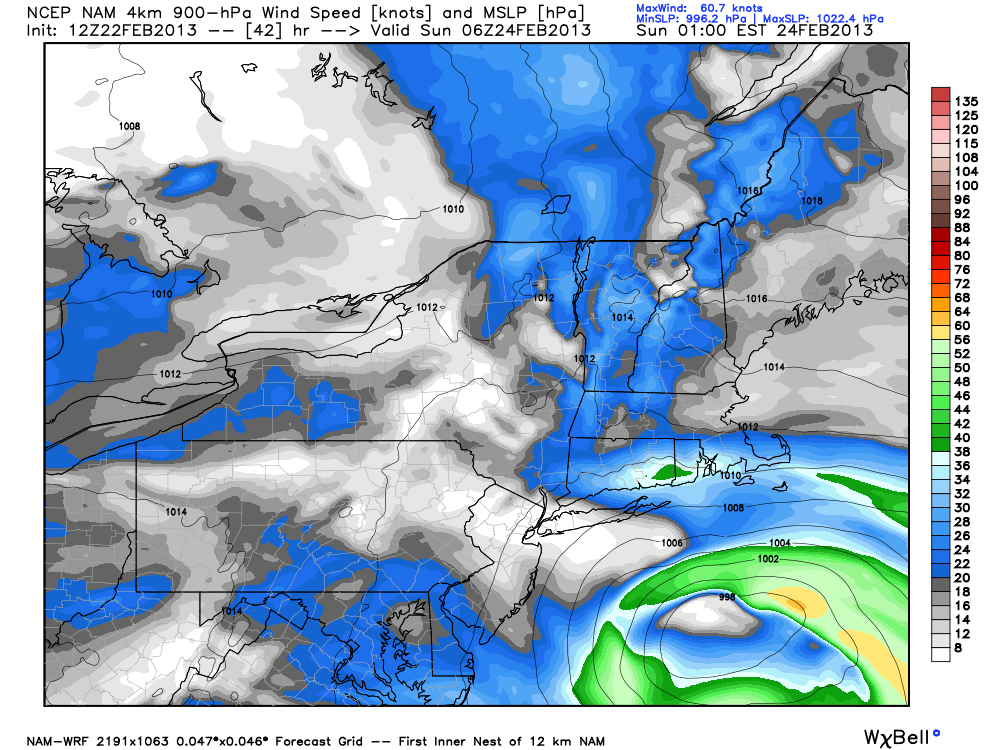
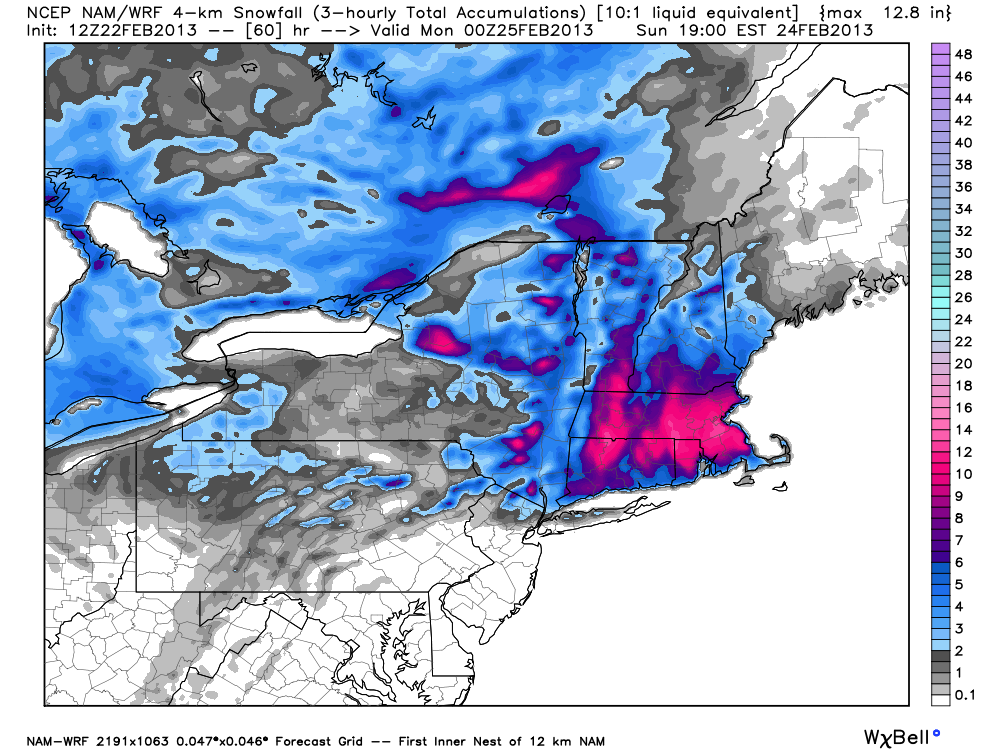
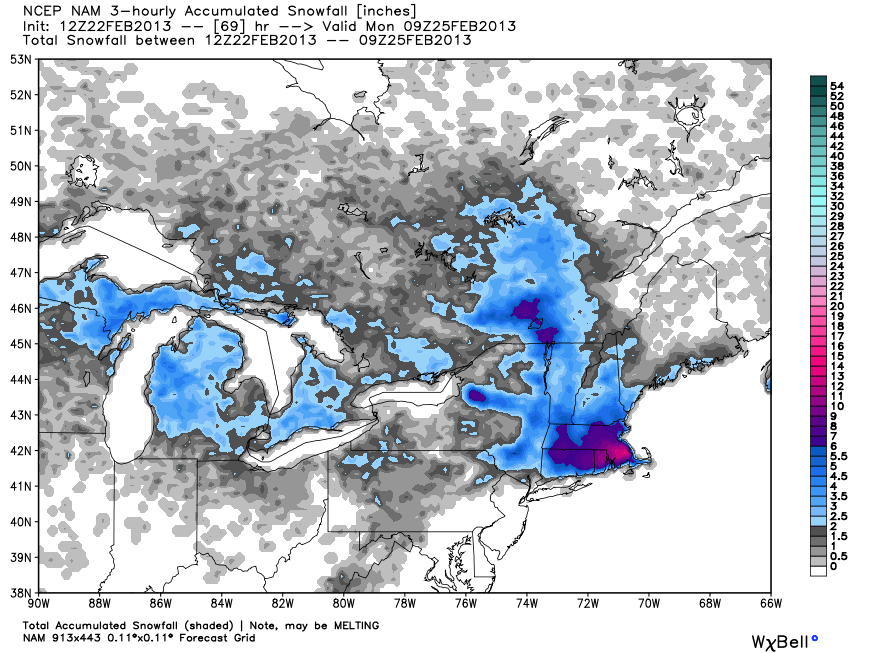
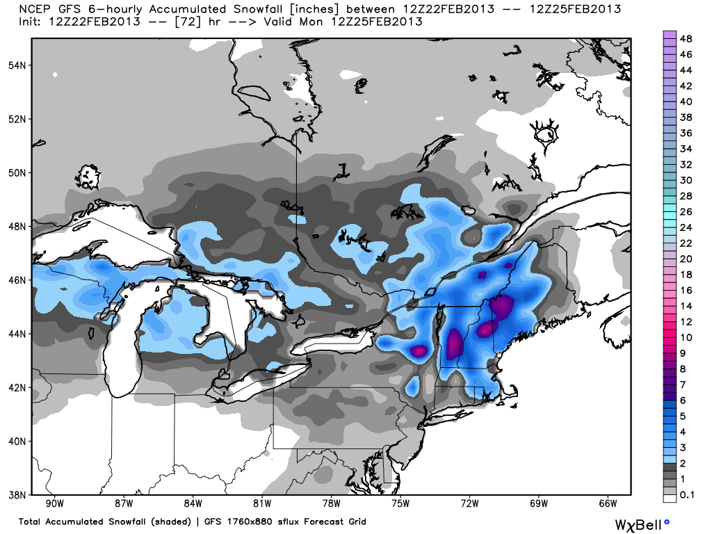
The NAM has been one of the colder models all along with this system. Friday morning’s run trended even colder, with a nice thump of snow at the start of the storm for most of Southern New England. If the 12km NAM verifies, then there will be about 6-10″ from Hartford, CT east to Plymouth, MA. There is the potential for a widespread 8-12″ of snowfall if the higher resolution 4km NAM verifies. Overall, this is a disconcerting trend from the NAM of bringing the heavier snow farther south into the I-95 corridor. The 12Z NAM puts the high end totals on the Right Weather accumulation map in play.
The 12Z NAM is also faster than prior runs. The precipitation ends in RI by early Sunday morning, and by late-morning in SE MA.

GFS (Global Forecast System)
The best word we can use to describe the latest run of the GFS is suppressed. The track of the storm is farther south with a lower impact in Southern New England. Yet, even with the track farther south, there is enough mild air that it’s mainly light-moderate rain in Southeastern New England. Frankly, it’s a far cry from what the other models are showing, There is only about 0.4″ of QPF Saturday night with this run of the GFS, that is less than half of what the NAM is showing, and about 2/3 of last night’s European. In this scenario, it’s not much more than a 2-4″ snowfall, with a lot of that coming Sunday and Sunday night as a disturbance rotates south from Northern New England as the storm departs. If this scenario plays out, it will be a huge bust for the areas near the MA pike that are expecting upwards of 8″ of snow. It won’t be as big of a bust in RI or SE MA where the current Right Weather forecast is for less than 4″.
12Z GEM (Canadian)
The latest run of the Canadian is also farther south with less precipitation than its prior run, but it’s not as meager as the 12Z GFS. The 12Z Canadian would bring a moderate 4-6″ snowstorm to places in CT, RI, and MA that are at least 10 miles from the ocean. That includes Kent and Providence Counties in RI, and interior Bristol and Plymouth Counties in MA.
12Z ECMWF (European)
The European falls into decent agreement with the Canadian and GFS on the first part of the storm through Sunday morning. It’s a minor-moderate event, with some rain moving inland to Providence Saturday night. The Euro has a decent wraparound Norlun trough setup late Sunday into early Monday. That could lead to an additional 1-3″ of snow, especially in E MA.
A tricky forecast! It’s not just the models that disagree:
Back to back Tweets on my timeline sum up the weekend forecast challenges. Storm is 30 hours away. #RIwx #MAwx #CTWx http://t.co/shoUOXLTRZ
— Fred Campagna (@FredCampagna) February 22, 2013


