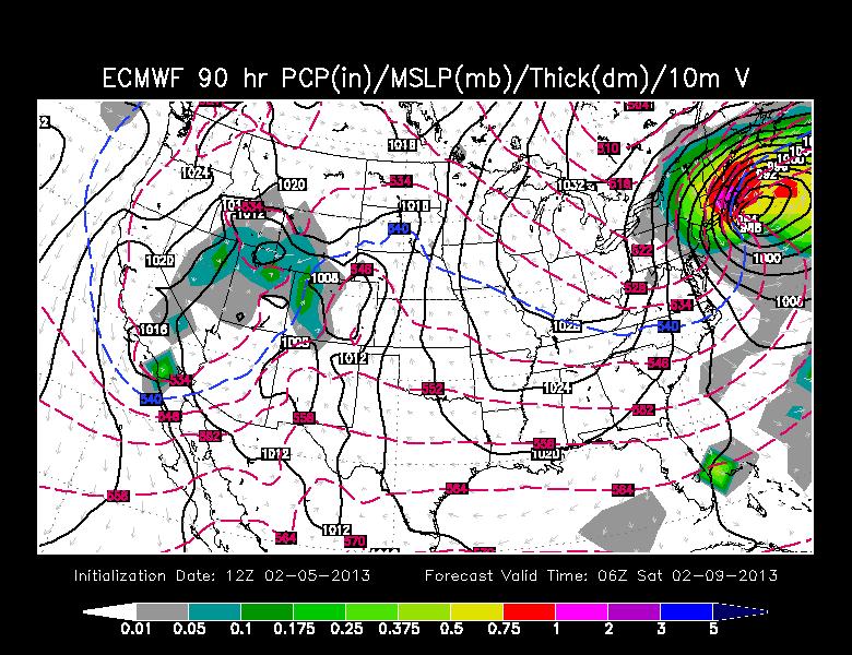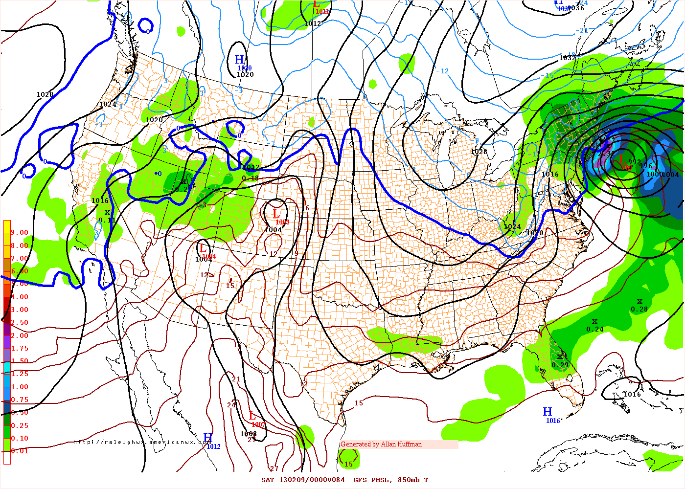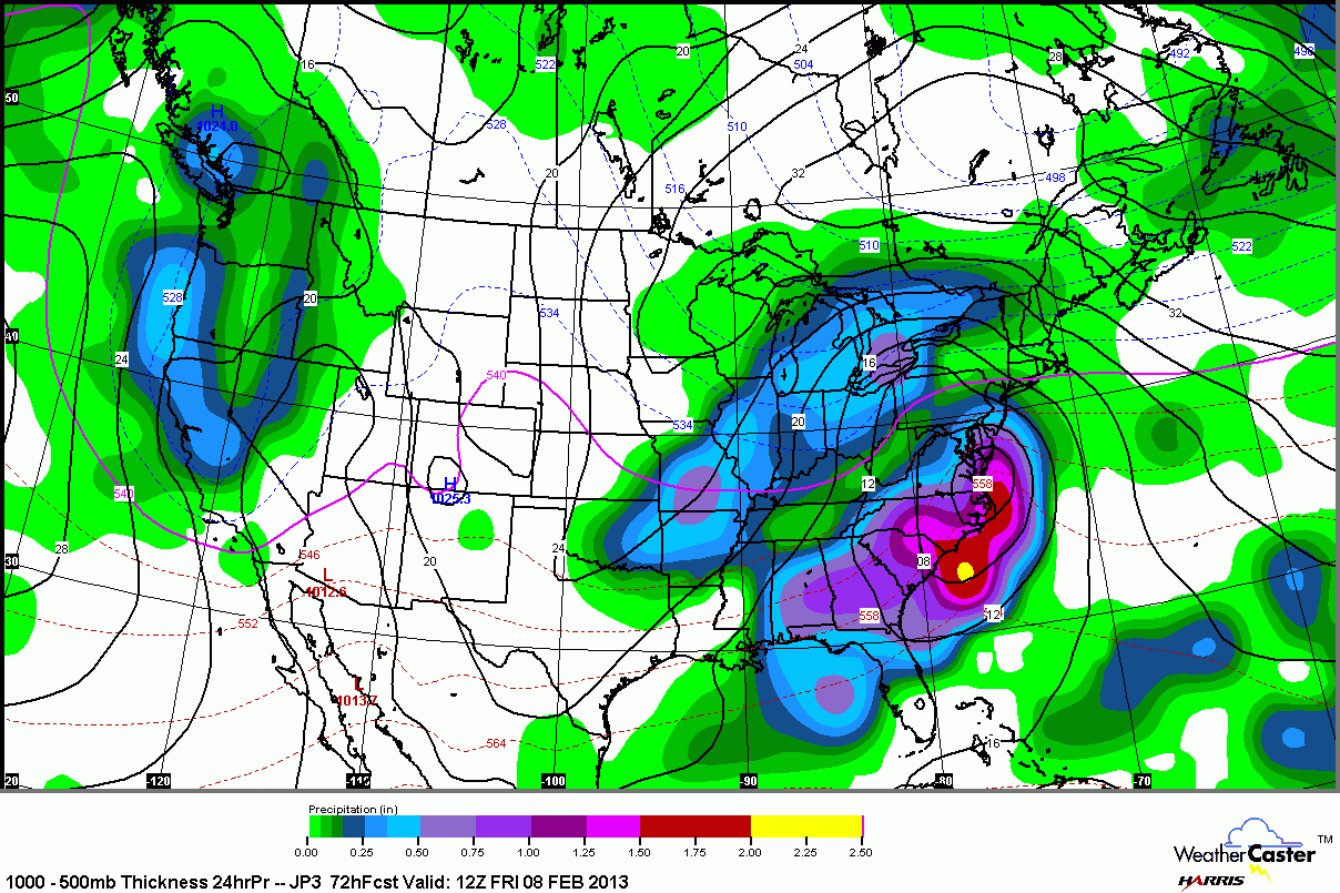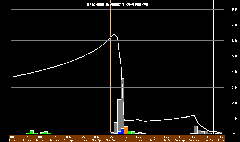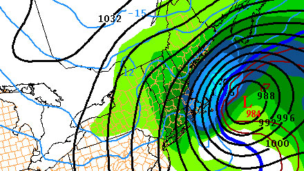
A potentially significant winter storm is in the works for Friday in Southern New England. The European computer model has been strongly suggesting that a storm would develop off the Carolina coast and head northeastward impacting Southern New England as a Nor’easter Friday into Friday night. For days, the GFS model was adamant about this storm not developing, with a much weaker Alberta Clipper moving through New England. As we theorized in yesterday’s Long Range Forecast, the GFS is has trended toward the European model’s solution, with a significant winter storm impacting Southern New England. The Canadian model also shows a Nor’easter, but it is a bit farther out to sea. Nonetheless, it would bring several inches of snow to Southeastern New England. The shorter-range NAM model is still not phasing the northern and southern branches of the jet stream, but it has a beefy enough northern branch system to allow for several inches of snow. Confidence is growing in a big impact event for Southern New England, but several important forecast details are still uncertain.
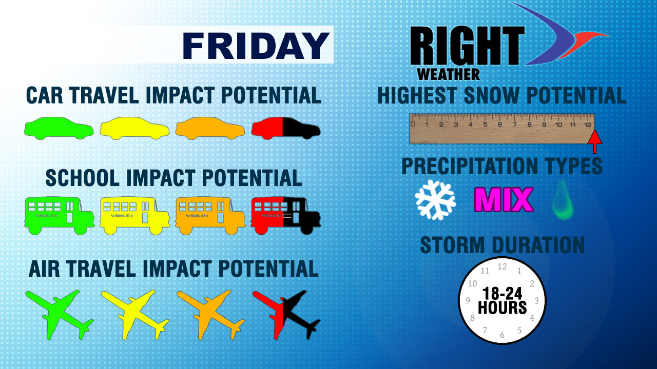
The biggest issue with this storm may be precipitation type. There will not be a ton of cold air left in New England as the storm develops to our south. As a result, if the storm is very intense and tracks relatively close to the coast, some mixing or rain will occur from the coast to the I-95 corridor. The timing is also not set in stone, but most computer models agree on the height of the storm happening Friday afternoon and night, with any precipitation ending by dawn Saturday. If the storm develops as forecast, the wind will be an issue, too.
Check out the graphics below and know that we will be doing everything we can to keep you up to date on this potentially major storm. Thanks for subscribing to Right Weather Pro, and, if you like it, be sure to tell your friends!