This weekend’s storm is a very close call between heavy, wet snow and chilly rain in Southeastern New England. While there is likely to be some rain in the southern half of Rhode Island and coastal Southeastern MA, the forecast gets very tricky in Northern RI and those living north of a Taunton-Plymouth line in MA. Computer model solutions have ranged from a mainly rain event for all of Southern New England outside of the Berkshires and Worcester County to a storm that brings another foot or more of snow to everyone northwest of the I-95 corridor. Here is the latest from the computer model runs received through midday Thursday.
Feel free to ask any questions in the comment section at the end of the blog. Click to enlarge all images.
A few things:
12Z run = 7 am EST initialization time
00Z run = 7 pm EST initialization time
QPF = Quantitative Precipitation Forecast (how much liquid precipitation falls – must convert for snow totals)
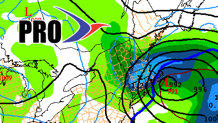
12Z NAM (North American Model)
The newest run of the NAM has very little snow for the first half of the storm from the coast to Providence as too much mild air surges in on an easterly wind while the storm develops. There is a brief period of non-impact snow before a change to rain that lasts for several hours into late Saturday night. The temperature stays in the mid 30s, and the wind slowly backs around to the northeast as the storm gets wound up and stays south of Southern New England. An inch of rain falls through 2-3 am Sunday before the precipitation changes to snow. This is where the model run gets very interesting. Normally, in these situations the heavy rain that falls is followed by a brief change to snow/mix before the precipitation shuts off as it moves north into Northern MA or Northern New England. Based on the 12Z NAM, however, the storm stays far enough south and moves slowly enough that there is a huge amount of wrap-around snow that impacts all of Southern New England late Saturday night through Sunday morning.
I can’t remember any storms where Providence received an inch of rain followed by nearly a foot of snow. Based on the way this February has gone, I’m not discounting any solution completely, but this would be an extremely rare event in the Providence area and near the coast. I think there’s a better chance of the quick burst of snow, followed by mainly rain, then ending as a touch of snow that doesn’t amount to much. I am also leery of how close Providence is to an all-snow event based on this NAM track. It warms just barely enough for a change to rain.
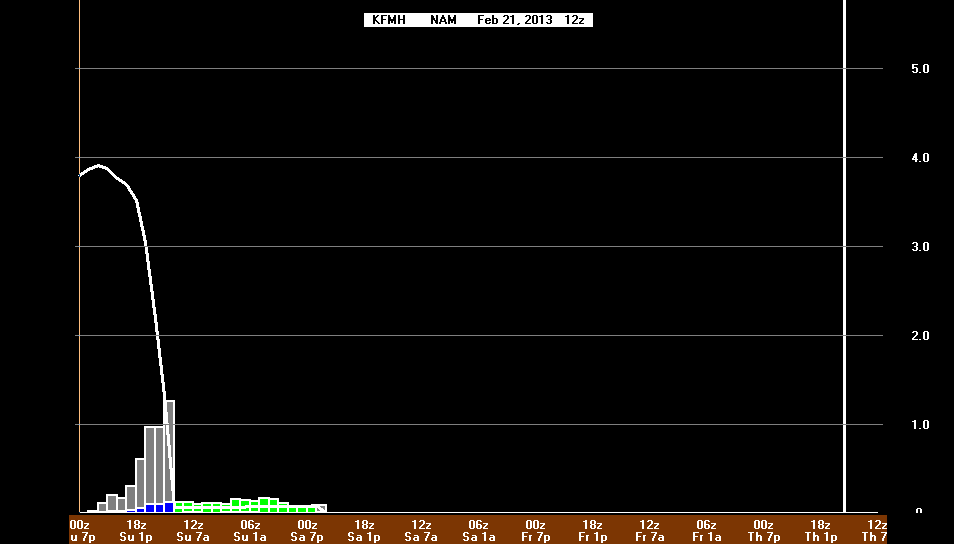
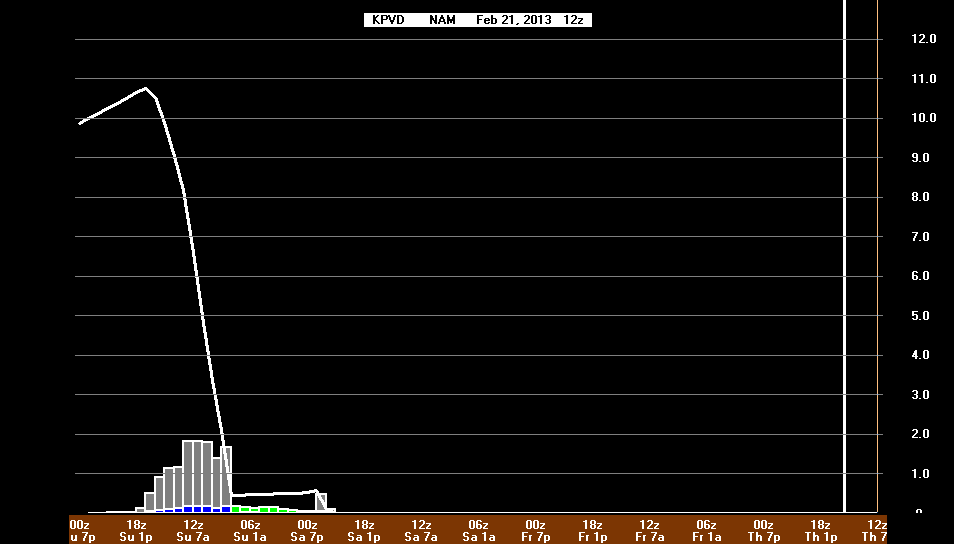
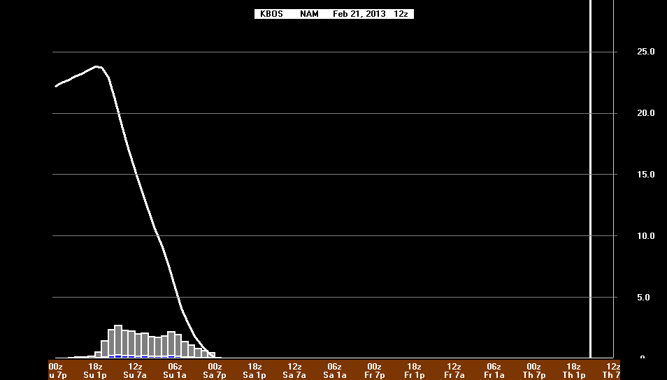
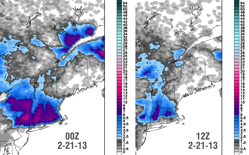
It is interesting to note that while the 12Z NAM has a big finish to the storm with several inches of snow from the coast to Providence, the first half of the storm is actually milder in those areas than last night’s 00Z run. That means if the back-end snow does not develop, then the snow impact from the coast to Providence is minimal.
12Z GFS (Global Forecast System)
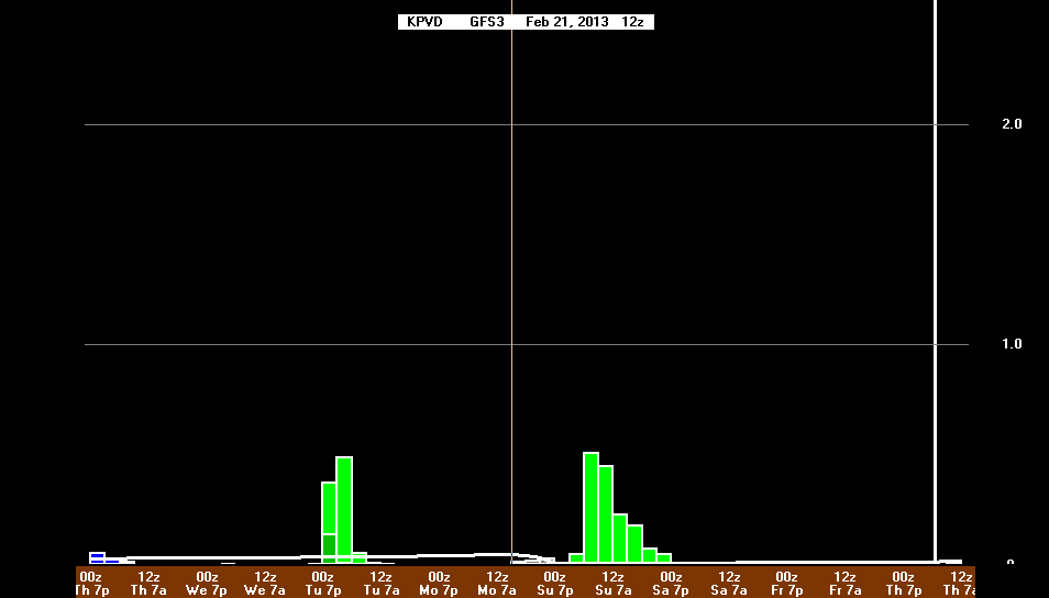
The 12Z GFS is about as close to a borderline rain/snow situation as your are every going to see in the I-95 corridor. The latest run has definitely trended slower and farther south than prior runs, with steady precipitation coming down through Sunday morning. The southward track also brings the snow a bit farther south, but, depending on how the information is interpreted it is still unclear if it’s snow/rain in Providence and Boston. Take a look at the graphics below. The snow map from weatherbell.com has 6+” in most of RI and SE MA, yet, the BUFKIT profiles, interpreting the same data have rain in Providence and a moderate snowstorm in Worcester. The bottom-line, since we’re talking about trends, is the GFS is trending colder with the storm on this run, but it’s still no lock that it will be all snow in the coastal plain of Southern New England.


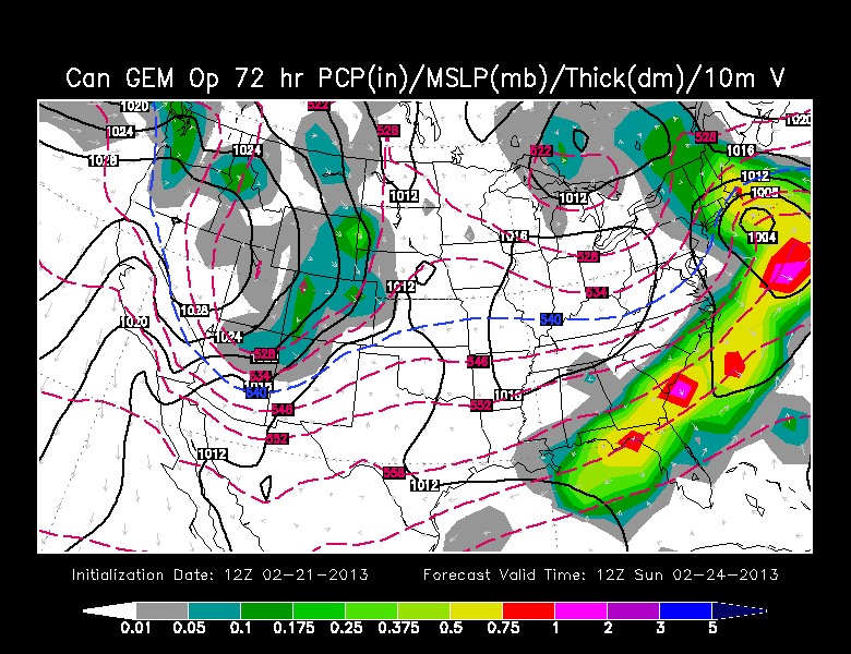
12Z GEM (Canadian)
The 12Z Canadian is a bit farther north than last night’s run, with a fairly high-impact storm that sits on the line between snow/rain in the I-95 corridor. Based on the storm’s position at 7 am Sunday, we would lean toward mainly snow in Providence at that point. The storm really beats up on E MA with prolonged moderate/heavy snow from Boston to Bourne most of the day Sunday. The Canadian, like most other models, has several hours of rain/mix in RI and SE MA Saturday night before the change to backlash snow late Saturday night or Sunday morning. As mentioned earlier, it’s rare to have a significant snow accumulation after several hours of rain in the Providence area.
JMA (Japanese)
The JMA takes the storm over the 70W/40N benchmark south of Nantucket. It has consistently had the coldest solution and has a moderate 6-12″ snowstorm. This run is just a bit milder than yesterday’s run, but still cold enough for mainly or all snow in the I-95 corridor.
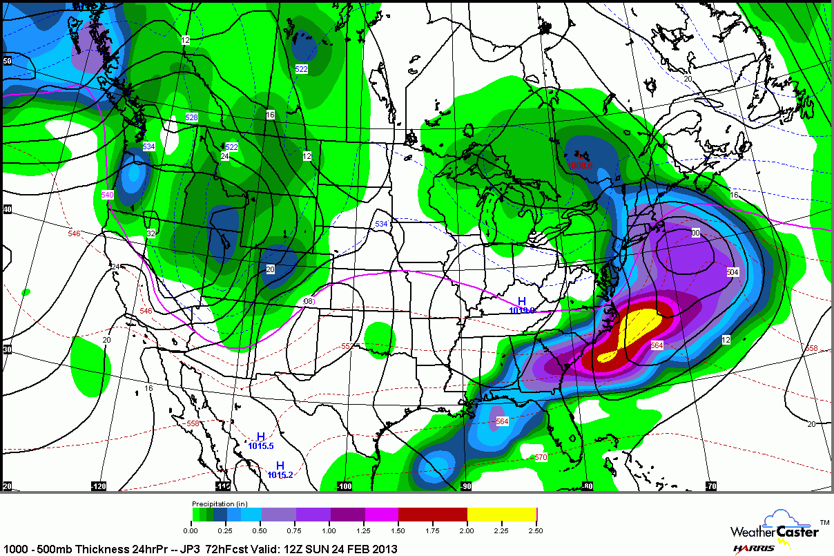
ECMWF (European)
The 12Z European brings the rain/mix line way inland (possibly to the MA pike) during the first half of the storm. The 12Z run features a decent wraparound snow event for Southern New England. Most of the models have it, but we’re skeptical of the potential for a significant snow event after 1″ of rain in most of RI and SE MA Saturday night.
Run to run, the 12Z is faster and just a bit farther south than last night’s run.
The Bottom Line
As mentioned in the post on how this week’s storm differs from the past two, the setup is not ideal for heavy snow from the coast to I-95 – especially during the first half of the storm. The weakening low pressure that moves into the Great Lakes brings too much mild air to the north, allowing rain to be a major factor Saturday night. The wraparound accumulating snow is a possibility, but we’re not counting on it yet. We think the best chance for another significant accumulating snow in most of RI and SE MA is if the storm ends up tracking 50 miles farther south than the models are currently projecting – which is certainly a possibility given that it’s 60-72 hours away.


