The computer models latched onto a wicked weather setup for this storm in the past 24-36 hours. Now is the time when we see if it’s reality or a bit overdone. Based on what we have seen so far, the potential is there for a historic Nor’easter to pound Southern New England with incredibly heavy snow and near-hurricane force winds. Here is what the latest computer model simulations available Wednesday night are predicting.
A few things:
12Z run = 7 am EST initialization time
00Z run = 7 pm EST initialization time
QPF = Quantitative Precipitation Forecast (how much liquid precipitation falls – must convert for snow totals)
Here is the current Right Weather accumulation map

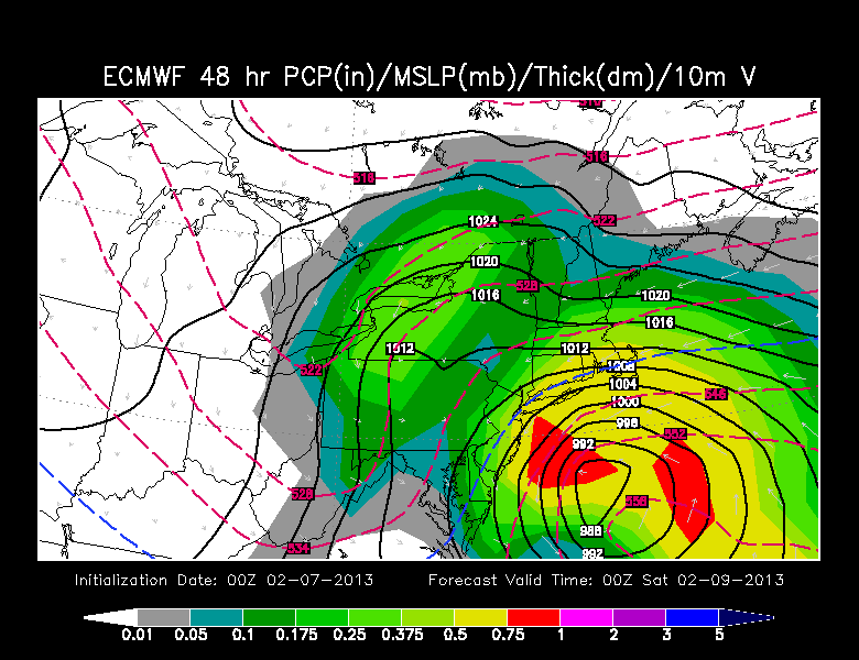
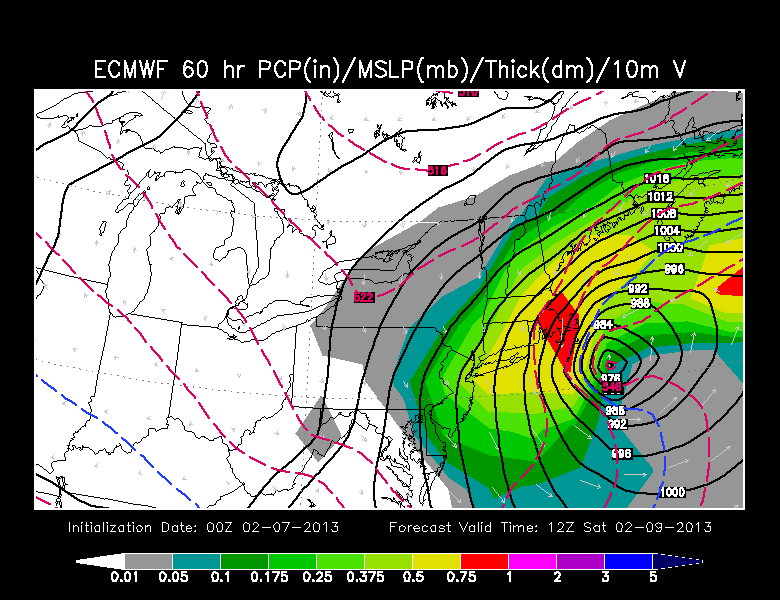
00Z ECMWF
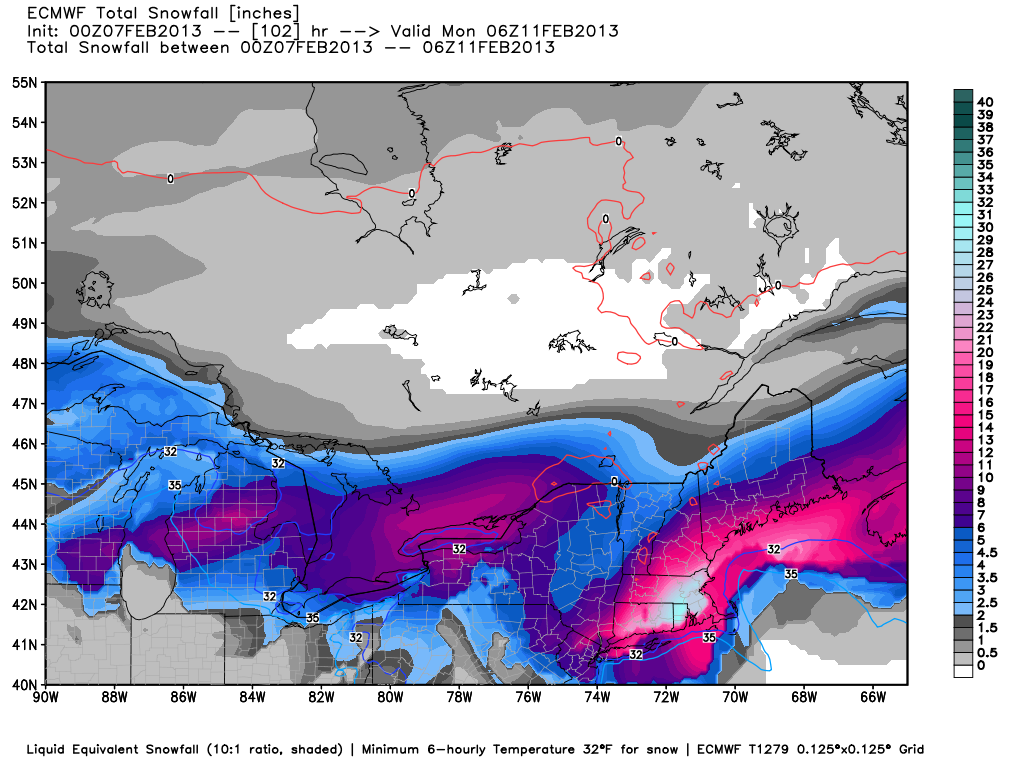
With the GFS backing off quite a bit, the 00Z ECMWF loomed as an important run for the storm and a forecaster’s confidence. Well, the run was strong and long with a track that is destined to bring a ton of snow to Southern New England. It provides about 3″ QPF to Providence, and the critical temperatures for snow/mix don’t make it above freezing – but they get close late Friday afternoon. The height of the storm is from 7pm Friday to 1 pm Saturday, and it moves very slowly as it gets southeast of Nantucket then moves due east. This is a perfect track for a historic storm in Southern New England. If this model verifies, it would be an 18-30″ snowstorm for most of the area, with the core of the heavy snow right over the Providence Metro area.
Winds would be very strong, probably sustained near 60 mph on the Cape/Islands, with some gusts well over hurricane force. Coastal flooding in E MA would be an issue because of the slow-moving nature of the beast.
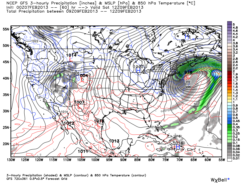
00z GFS
The new run of the GFS has backed off considerably from prior runs. A slight jog to the east and a faster moving system than most other models have adds up to a lower impact storm for Southern New England. Snow totals are still impressive, but the bar has been set so high for this storm that it would be a let down for those with dreams of this storm being an all-time great. The totals are about 8-16″ in most of RI and SE MA, with the bulls eye near Taunton, MA. The storm is progressive an out of the picture by midday Saturday. This was good model run if you’re not particularly hoping for 2 feet of snow and hurricane force winds.

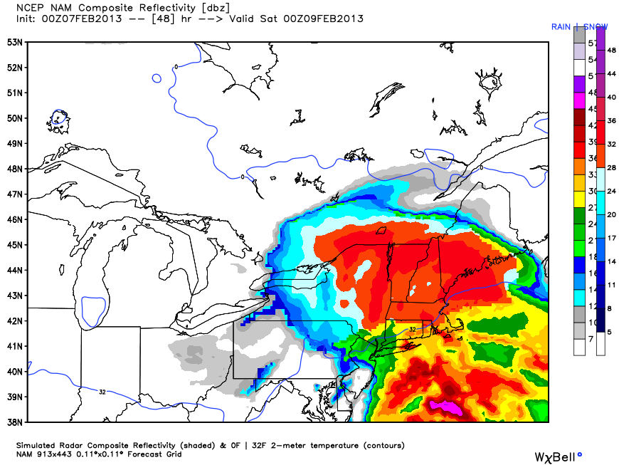
00Z NAM
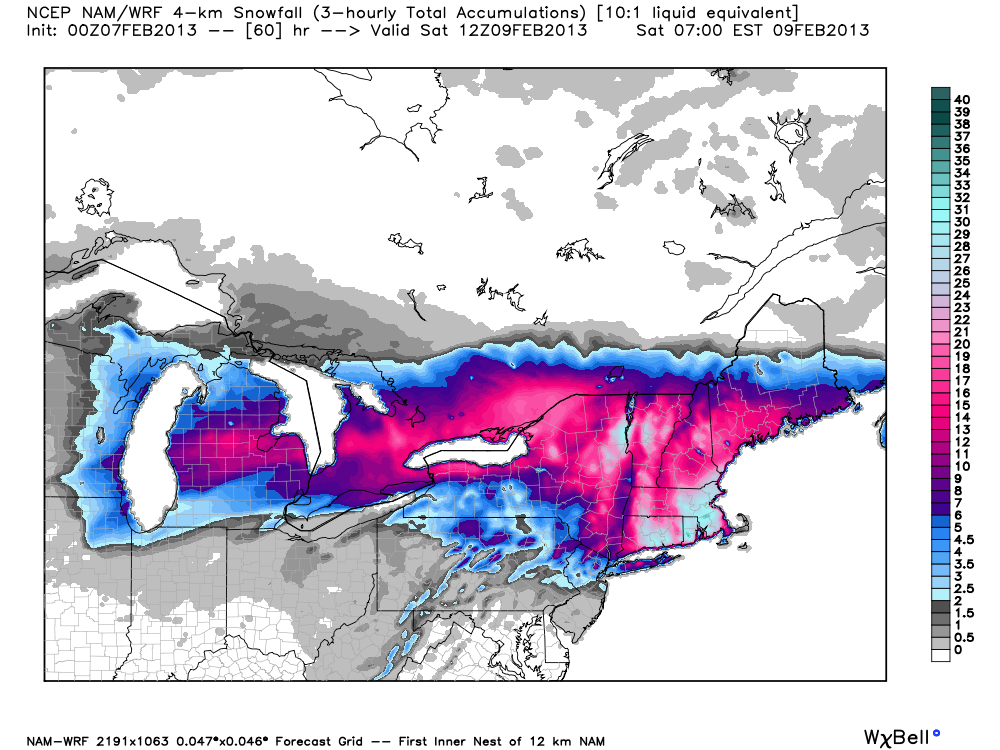
The NAM model is much maligned in the meteorological community. I’m not 100% sure why, because in the short term I think it does a decent job. It’s now getting to the short term with this storm, and the NAM is predicting some interesting things. First, the new model run takes a surge of milder air into the coast of Southern New England Friday evening. As a result there is likely to be some rain or mixing from the coast to about Providence. In the model run, however, it does not come at the height of the storm, so there is still plenty of time for a significant accumulating snow, even near the coast. The predicted snow totals are abnormally high (think Blizzard of ’78) and I think they’re a little overdone.All Posts
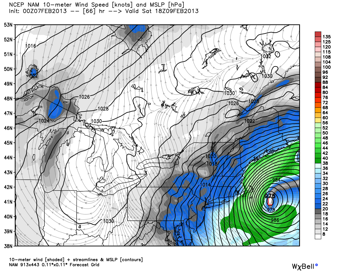
The storm is also a slow-mover. This is a trend that we’re seeing with most computer models. It looks like this storm will still be raging through most of Saturday. That will lead to a prolonged period of heavy snow (especially in E MA), strong winds, and coastal flooding with several high tide cycles impacted. Moderate flooding is possible in Eastern MA, and significant beach erosion may occur due to the battering waves.
The 00Z run is a little warmer than the 12Z run, but it makes up for it with a longer-duration storm. The end result is still astronomical snowfall totals in most of interior RI and SE MA.