(GEM)Canadian
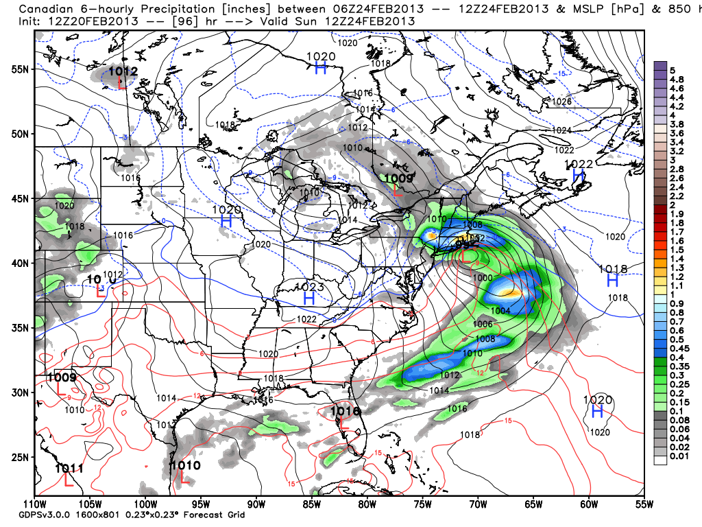
Last week, the Canadian consistently had the weekend storm too close to the coast during the midweek runs. This week, it is also tracking the storm fairly close to the coast, and, as a result, rain is the predominant precipitation type for Southeastern New England from the coast to I-95. It’s a different story inland, with heavy snow falling in N RI, interior MA, and interior CT. It’s the same setup as most models, and that’s a storm that tracks close enough to throw the wind around to the east and bring in air that’s just mild enough to change snow to mix/rain within 20-30 miles of the coast. The position of the high pressure center to the east-northeast of New England is not ideal because it fails to lock in the colder air by forcing the wind to the northeast instead of the east.
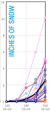
SREF (Short Range Ensemble Forecast)
The SREF is just getting a whiff of the storm because the run only goes out to 7pm Saturday. Most members bring some snow before any change to rain. This type of ensemble forecasting, where the mean (average) is looked at is becoming increasing popular in the meteorological community, and we’ll be looking closely at it in the coming days.
ECMWF (European)
The 12z Euro brings mainly rain to Southeastern New England, with the storm tracking closer than most other models. We’re not allowed to show ECMWF maps on the site, but we can tell you that the storm tracks just south of Long Island then over Nantucket – much too close for mainly snow in RI and SE MA given the position of the high to the east-northeast and an easterly wind direction. If the 12Z Euro verifies, the lion’s share of the snow will be north of the MA Pike. There would be a brief front-end thump of snow in RI and SE MA, but the bulk of the storm would be chilly rain. The Euro has about 1.5″ of QPF in the Providence area, with about 2″ farther inland into Central MA. That indicates this could be a major snow event for the areas that stay all snow in N MA and S NH, VT, and ME.
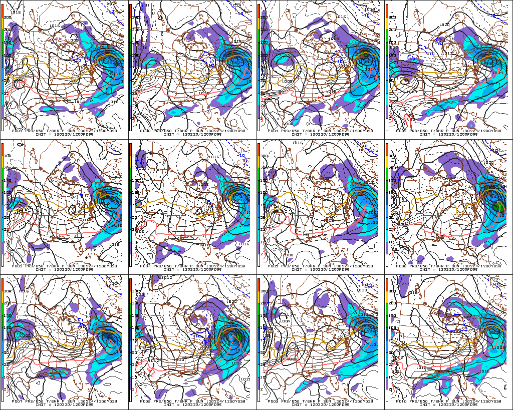
GEFS (Global Ensemble Forecast System)
All the GEFS members have a storm impacting Southern New England. Overall, there is excellent agreement on the timing and track of the system, with most bringing a snow-rain scenario to Southeastern New England.
The bottom-line
The trend in the 12z models is for the storm to track close enough to take the possibility of a major snowstorm off the table for coastal Southeastern New England. Farther inland, from NW RI, N CT and interior MA to Northern New England, there remains a threat of heavy snow. Since we’re just analyzing run to run trends, I think it’s important to not waver too much on the general idea of the forecast: A storm will bring moderate to heavy precipitation to Southern New England this weekend. It will likely begin Saturday afternoon and peak Saturday night before winding down on Sunday. Right now, the track favors snow to rain, especially near the coast, but it is too early to say if the current projected track will hold as the jet stream energy is just now reaching the Southwestern United States.


