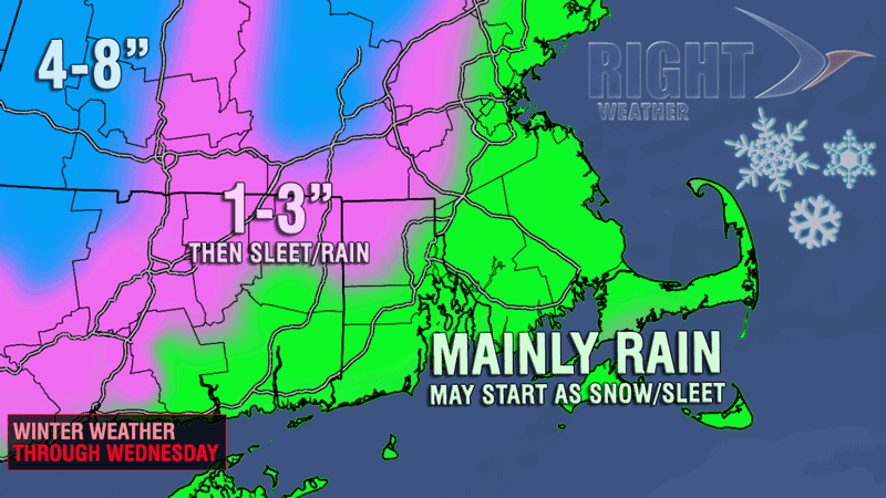
Another wintry mix is heading for Southern New England to help round out what has been one of the snowiest Februarys on record. The storm looks like mainly rain for the big cities as milder air arrives around the same time that the precipitation begins falling. A couple of hours of snow/sleet is possible in the I-95 corridor late Tuesday night, but it looks like any wintry precipitation will change to rain from Boston to Providence to Coastal Connecticut by the Wednesday morning commute. There should be less than an inch of accumulation in those areas.
Farther inland, the cold air will hang on for a few more hours, and minor accumulations are possible in NW RI. The precipitation should be changing to a wintry mix of snow, sleet, and rain during the Wednesday morning commute in NW RI and Worcester County, and travel may be slowed as a result. The best chance of picking up 2-3″ of snow is at the highest elevations.
This system will be a decent snowmaker for the Berkshires and the hills of northern Worcester County. More than 6″ of heavy, wet snow is possible before a change to a wintry mix of sleet and freezing rain on Wednesday.
The brief period of snow/sleet near the coast will be followed by steady rain through most of Wednesday. Some areas may pick up 1″ of rain. It will be a raw day, with the temperature in the upper 30s to low 40s.