
It look like it may be “here we go again” for Southern New England as the computer models are finally coming around to a solution that delivers accumulating, probably plowable, snow to RI, MA, and CT Saturday night into Sunday morning. All week long, the upper level air pattern has looked very risky for some snow along the Northeast coast. The computer models were having a difficult time handling the energy in the jet stream, and, as a result, most were failing to cook up a storm of much impact in Southern New England. The American computer models are singing a different tune Thursday morning.
The potential exists for a significant snowfall, but not quite to the extent of last week’s blizzard. Saturday afternoon, a fast-developing storm will form east of the Mid-Atlantic and move due north. At the same time, much colder air will be moving into Southern New England on a northerly wind. The eastern half of New England will clipped by the developing storm with some snow and wind Saturday night. There may a sharp west-east cutoff on the snow accumulations depending on where the storm forms and the track it takes to the north.
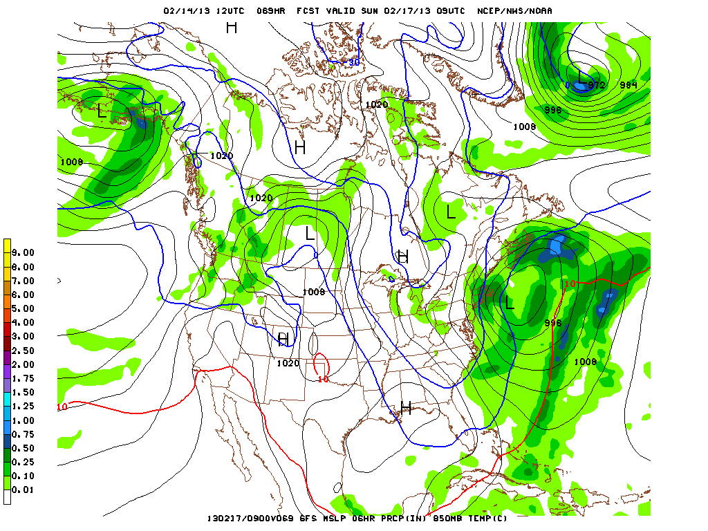
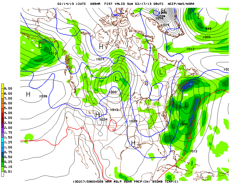
Right now, we think it is likely that most of RI and E MA will have a plowable event, with the chance of more than 6″ of snow. Since this is a very tricky weather setup, this forecast comes with a little less confidence than usual. In fact, two days prior to the blizzard we had a much better idea of that storm’s impacts compared to this one. Not all of the computer models agree that the storm will form and come close enough for a moderate to high impact storm. Stay with rightweather.net for the latest.


