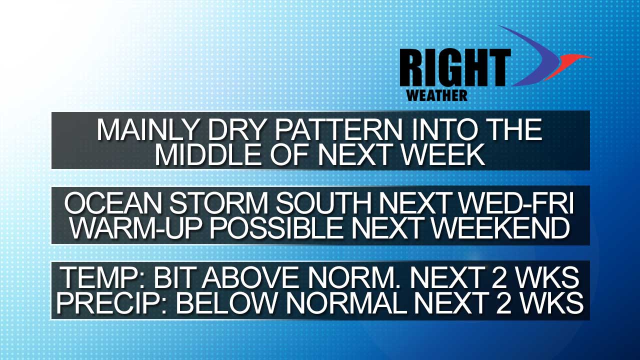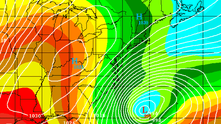
The overall weather pattern will not be changing much in the first week of March. A negative North Atlantic Oscillation means a predominant north-northwesterly wind direction in Southeastern New England. Right now, it looks like the storm track will be suppressed far enough south that the weather will be mainly dry. One system worth watching is a storm that will likely form off the Southeast U.S. coast by the middle of next week. It looks like it will be staying south of Southern New England, but, should it drift north it would be a real headache with snow/rain and strong winds. After that system drifts farther into the Atlantic, a 2-3 day warm-up may follow for the second weekend of March when clocks change and Daylight Saving Time begins. That’s the best chance of seeing 50°+ weather in the next two weeks.