Long Range Forecast – February 4

The parade of Alberta Clipper is occurring, but, unfortunately for snow-lovers, it has been a parade that we have watched pass Southern New England with very little impact. Two more Clippers will bring the threat of snow showers Tuesday and Wednesday mornings. It looks like the best chance of light snow Tuesday morning is near the coast.
The big ticket item this week is a potential storm on Friday. It’s amazing how divergent the solutions are between the different computer models right now. The ECMWF (European) and UKMET both have a Nor’easter for New England, while the GFS and Canadian have nada. It all has to do with the speed of a southern stream disturbance and its subsequent phasing, or lack thereof, with a northern branch disturbance. Obviously, the UKMET and ECMWF both phase the two streams to allow for some rapid development off the Carolina coast. It should be noted that the models have all been fairly consistent with their individual solutions for the past few runs, but the ECMWF is slowly trending to a more suppressed system. At this point, the ECMWF has gone from a snow/rain system for Southern New England to a mainly snow Nor’easter. If the southward trend continues, however, it would fall into being another near-miss.
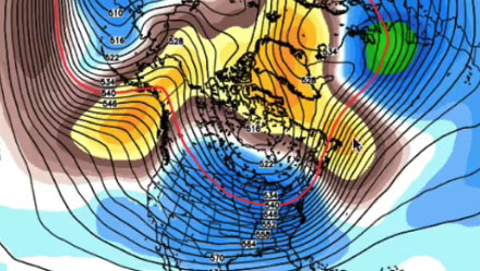
All indications are that there will be a slight warm-up next week. It does not look as pronounced as the 60° thaw that hit Southern New England in the end of January. The pattern will be a fairly stormy one as the southern branch of the jet stream gets more involved over the next couple of weeks. The North Atlantic Oscillaion (NAO) also appears to be trending negative, which means the potential for bigger, slow-moving storms near the Eastern Seaboard. That has not been the case so far this winter, and it’s uncertain whether those storms will form and if they’ll track close to the coast and bring rain or offshore and bring snow, but the overall pattern favors a stormier than normal pattern.


