We, at Right Weather, have never seen a situation where a storm is 12 hours from starting, or has already started if you want to count the snow showers this morning, and the computer models are so divergent on the impact of a developing storm in Southeastern New England. I have a coffee sitting to my left as I type this, but, believe me, I don’t need it! This is the kind of juice that makes forecasting Southern New England weather so exciting. Even in 2013, with a wealth of technology in our hands, the atmosphere is still rather unpredictable. It’s in a situation like this where we turn to some of the fundamentals that we learned in meteorology school, and some even turn to their Maine Coon cats for advice!
#mainecoon in storm posture. game on #LX pic.twitter.com/9gtohYPM
— Tim Kelley (@SurfSkiWeather) February 16, 2013
The funny thing is we had a Facebook follower last week posting this picture of her cats at their food dishes. Notice the picture on the wall. When the tails are curled toward each other, bad weather is coming. When they curl in the opposite direction, there are no weather concerns. For what it’s worth, she messaged me to say that the tails are in “safe” mode today.

Ok, enough about the cats, what are the computer models predicting? Well, they are all over the place.
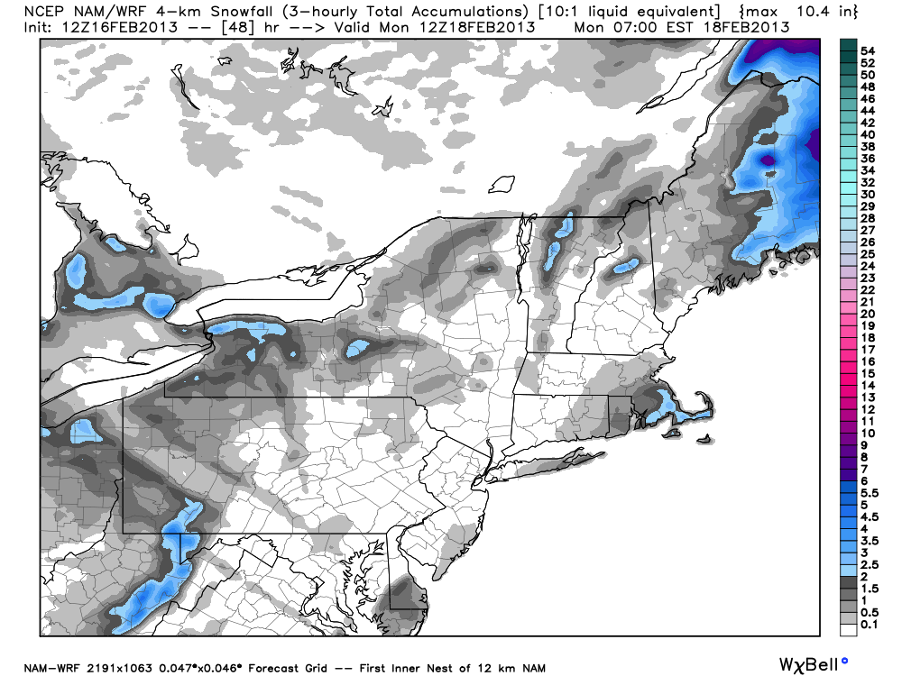
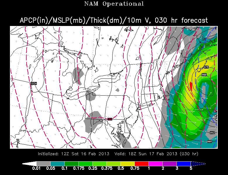
NAM (North American Model)
The NAM has never had more than a few inches of snow from this storm as it passes far enough offshore that it’s a glancing below on Cape Cod, with very little impact in RI and interior SE MA.
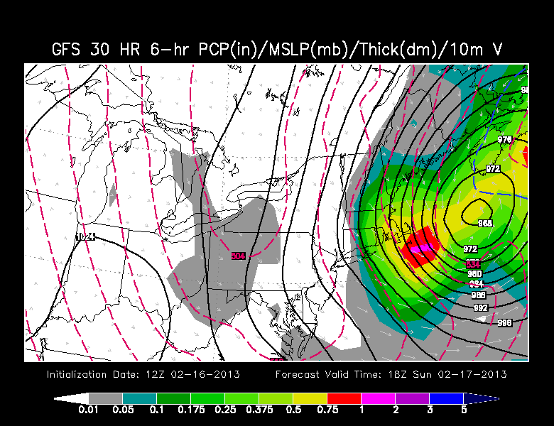
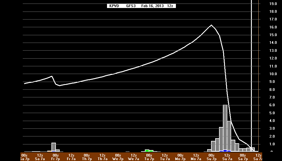
GFS (Global Forecast System)
The GFS has been the most consistent model in bringing a significant weather event to Southern New England Saturday night into Sunday. It has blizzard conditions in E MA, with another heavy snowfall for all of RI and SE MA. I don’t believe this has much of an impact on this forecast, but the GFS was the worst model in handling last week’s blizzard. Of course, when other models had it moving slowly and closer to the coast, the GFS had it moving quickly and farther offshore. This week, it’s the opposite. Again, I don’t think that has much bearing on this week’s forecast.
While the GFS may be overdone in its huge snowfall totals, it looks like a plausible scenario given the upper-level wind pattern that is in place over the Eastern United states. It’s an indication of how this weather pattern is “playing with fire”, it is very easy to get burned if the storm travels just a bit farther west than the NAM is projecting.
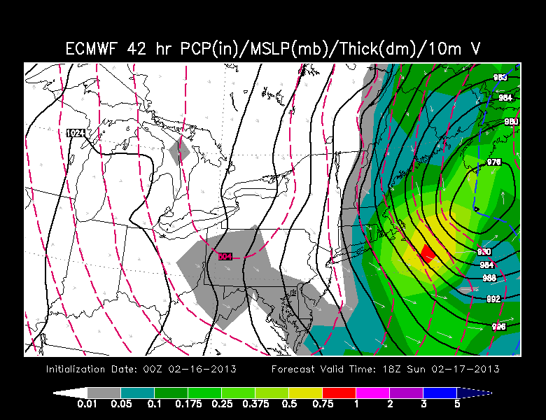
ECMWF (European)
The Euro is the widely considered the most accurate computer model on the planet. Even so, it’s not immune from botching forecasts. Remember the 1-5″ that fell a couple of nights ago? Well, the Euro had 0-1″ for all of Southeastern New England. Interestingly, the Euro did not even consider this storm an option until a couple of days ago. Now, it keeps trending toward a greater impact. The latest information will be out this afternoon and this will be updated, but, based on last night’s run, the possibility of a widespread 3-6″ (RI and interior SE MA) and 5-10″ (Cape Cod) snowfall is rather high.
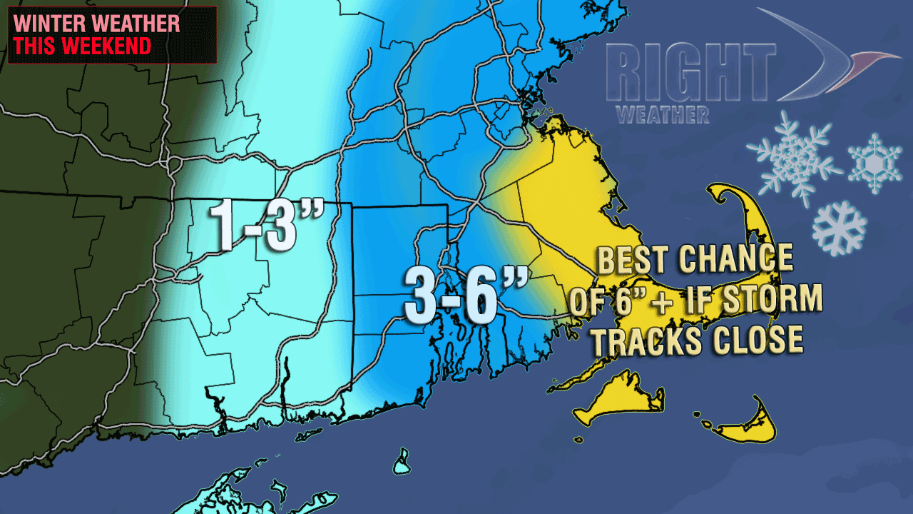
Summing it up
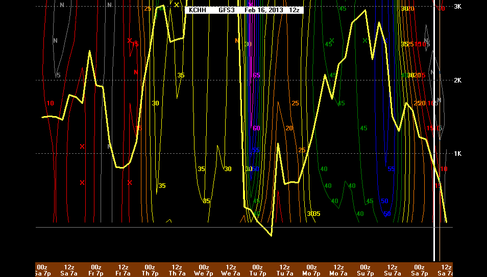
Snow is breaking out over the Southeast Saturday afternoon. The storm will quickly get organized off the Carolina coast and move northeast. It will completely “bomb” out in the next 24-30 hours, with the pressure dropping from over 1000mb to lower than 970mb. The upper-level wind patterns indicate the very sharp dip in the jet stream that will help to bring the storm more north than northeast. There is a 100-150 mile difference in the track of the storm between the models that take it offshore and those that bring it closest to Southern New England. That is the difference between 1″ and 12″ totals.

In this case, I think the two most extreme solutions (NAM and GFS) are unlikely to occur. The NAM is too far east, and there should be a decent snowfall on Cape Cod, with, at least, a nuisance snowfall over RI. The GFS, however, is probably taking the storm too close with another major impact storm in RI and SE MA. If the GFS verifies, it will be as close to a surprise Nor’easter (or blizzard) as can occur in this day and age. The Right Weather forecast has been fairly consistent for a few days, and we see no reason to make big changes to it right now. It looks like a light-moderate storm in RI and interior SE MA, with a solid moderate event on Cape Cod and Nantucket.