If everything goes according to the plan, we’re less than 48 hours from the first flakes in Southern New England from what will likely be a major Nor’easter in Southern New England, and possibly parts of New York and Northern New England. The computer models are still spitting out varying solutions, but the consensus is that Southern New England, particularly Northern Rhode Island and interior Southeastern Massachusetts will get the brunt of the storm. Does that sound familiar? Today is the anniversary of the Blizzard of ’78. While we’re not ready to compare this storm to that one, it certainly has the potential to be in the same team picture of the biggest snowstorms to hit Southern New England since then.
Here is a look at the first Right Weather accumulation map for the storm. It’s not without a lot of trepidation that we issue a first look map with a low end of 10″ in the hardest hit area. It’s possible this forecast busts, but after deciphering all of the computer model information in the past 12 hours, there is a rather high likelihood of more than 10″ of snow in a good chunk of Southeastern New England.
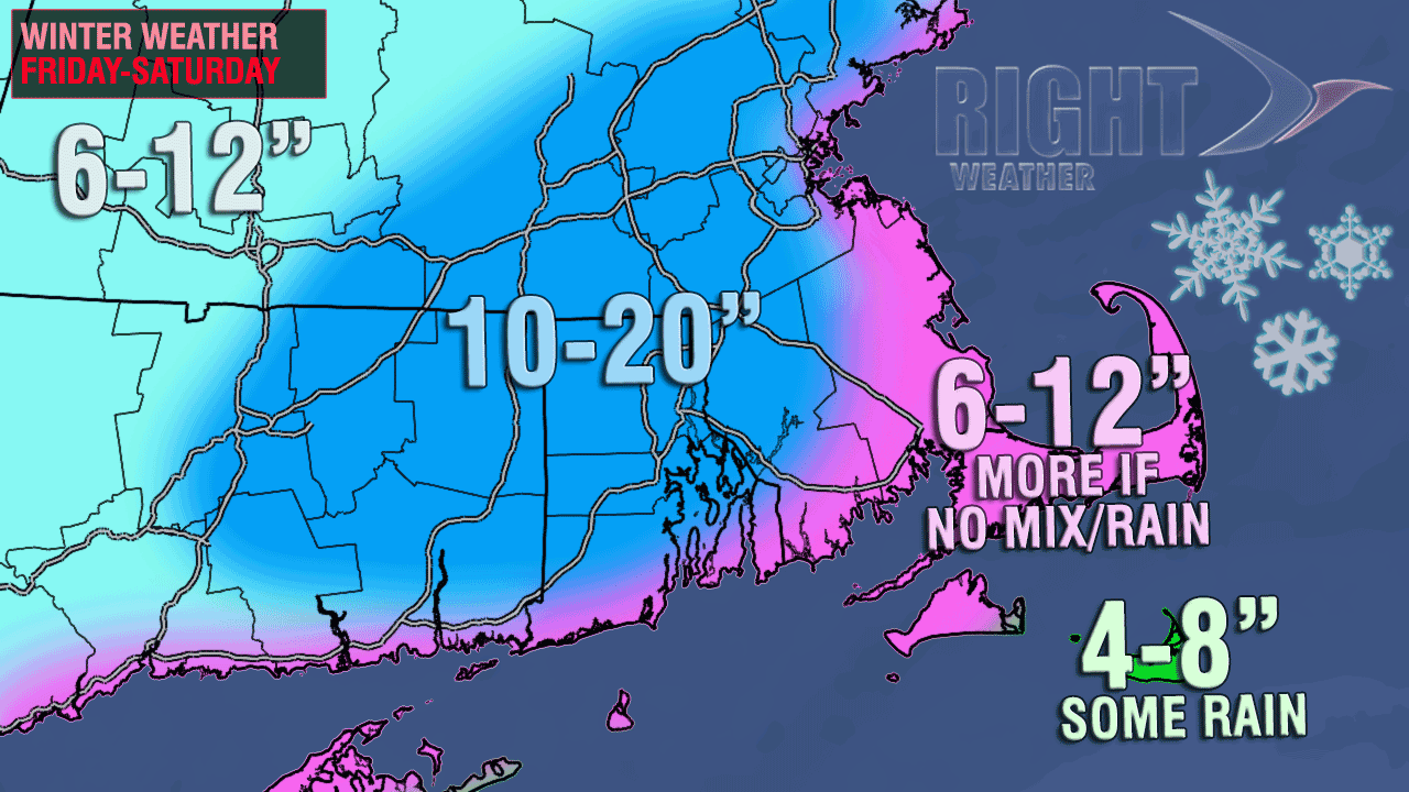
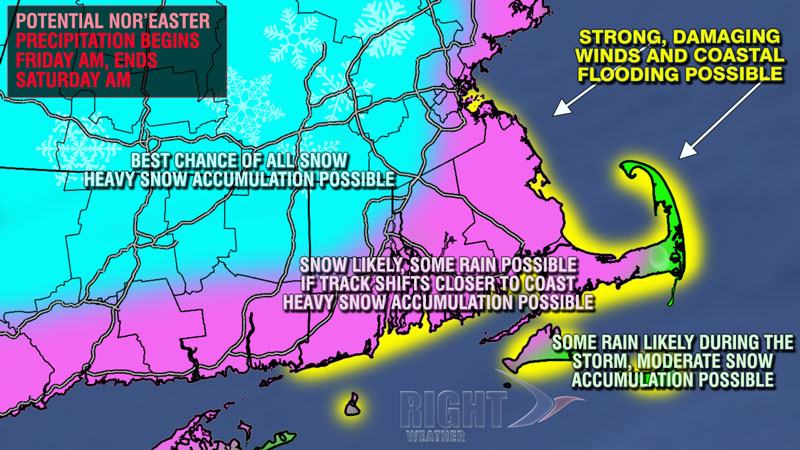
The area shaded in pink is where we’re most concerned about some rain or a mix bringing down the totals. If that doesn’t occur, then the totals will be similar to what falls in the darker blue area. The best chance of mixing that will significantly cut down accumulations is on Cape Cod and Martha’s Vineyard.
So, what can go wrong with this forecast? First, if the storm tracks closer to the coast, then you can take all these contours and push them farther inland, putting mainly rain near the coast and Cape Cod, a wintry mess in the I-95 corridor, and the jackpot snow totals into Far NW RI, Worcester County, and Northern New England. Second, the storm could still move farther out to sea and not be as intense as the models are currently projecting. That takes 10-20″ out fo the occasion, and probably leaves a widespread 6-10″ snowfall for all of Southeastern New England. That’s not the likeliest scenario, but it’s still on the table.
If we had to throw odds at it, they’d be something like:
- 30% storm tracks closer than forecast with mix/rain edging inland
- 45% storm tracks as projected with the a major Nor’easter (possible blizzard) for most of Southern New England
- 25% storm tracks out to sea and it’s a weaker, but still fairly substantial snowstorm