The thick snowpack over Southern New England continued to melt on Tuesday with a blend of clouds and sun, and highs in the low to mid 40s. Some of the standing water will refreeze Tuesday night as the temperature falls into the low to mid 20s by dawn. It will become mainly clear overnight.
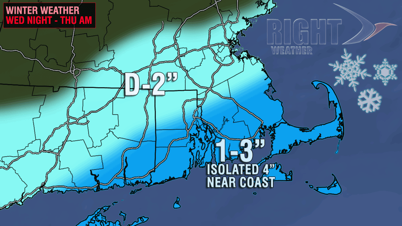
Wednesday looks similar to Tuesday, although it may be a few degrees cooler with highs in the upper 30s to low 40s. Clouds will increase Wednesday evening as a storm moves from the Southeast to the Mid-Atlantic. Some light snow is possible late Wednesday night into early Thursday morning. The best chance of picking up a few inches of snow is near the coast, and particularly on Cape Cod and the islands. Inland, it may just be some snow showers or flurries, and it will likely not have a big impact on the Thursday morning commute.

The fast-moving system will be gone by mid-morning Thursday, and there should be some sunshine Thursday afternoon. The weather will be fine Thursday evening if you plan on taking your Valentine out to dinner. Highs will be in the low 40s. The weather looks fairly quiet on Friday, with partly sunny skies and highs in the low to mid 40s.
Looking ahead to the weekend, there is the chance of some light snow on Saturday, followed by blustery and colder weather Sunday into Presidents’ Day. There is still the possibility that a storm develops in the Atlantic Ocean and comes close enough to bring snow/wind to Southern New England, but, right now, that is not the most likely scenario. Highs will struggle to reach 30° on Sunday, and it will stay chilly on Monday.


