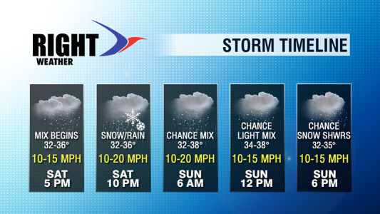
The threat of accumulating snow continues to dwindle as we approach the weekend. A storm moving from the Southeast to the Atlantic Ocean will develop farther out to sea than previously projected. The result is a weekend without a significant storm threat in Southern New England, for a change. Instead, there will be a nuisance system that brings some light snow and rain to Southern New England Saturday night and Sunday. The initial storm will be very weak and well south of Southern New England. It will be breezy near the coast, but damaging winds are of no concern.

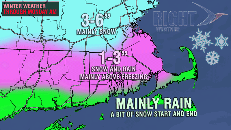
The temperature this weekend will be at or above freezing in most of RI and SE MA. As a result, snow that falls will have a difficult time sticking on any treated surfaces – even at night. During the day, if snow lingers on Sunday, it will fail to accumulate in RI and SE MA. The end result is little to no accumulation through Sunday afternoon for most of the area, with a chance of 2″ north of Providence if the cold air hangs on Saturday evening. There will most likely not be plowable snow anywhere in CT, RI or SE MA.
Snow showers or light snow may continue Sunday night. At this point, it does not look like anything more than a minor accumulation in RI and SE MA, but the area from Boston to Worcester will have to be monitored for a bit more snow if the disturbance moving through is more robust than currently projected.
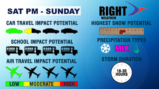
Check out the updated graphics below for the latest on this minor winter weather event.


