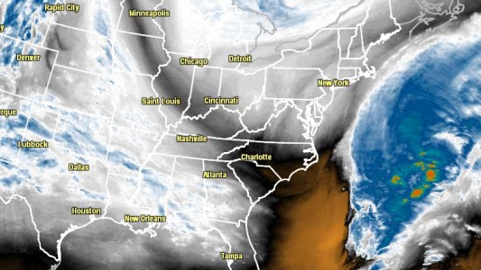
Energy hanging behind a large, developing storm in the Atlantic Ocean will move through Southern New England providing more accumulating snow to parts of RI, CT, and SE MA that have already seen well more than their fair share of snow this season. While it’s not likely to be a heavy snowfall, there should be enough to clean off cars, and possibly shovel/plow in a few locations by Friday morning. Thursday will be mostly cloudy with occasional snow showers and light snow, primarily in the afternoon. Snow will not accumulate on the roads during the day Thursday because of the high early-spring sun angle and temperatures that are expected to be at or above freezing.

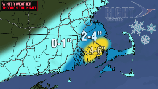
Once the sun sets and the snow gets steadier there is a better chance for it to stick. The steadiest snow is expected Thursday night in RI and SE MA. Any accumulating snow should wind down around dawn on Friday, with some lingering snow showers and flurries possible during the day. It will stay chilly with lows in the upper 20s Thursday night, and highs in the mid to upper 30s on Friday. The best chance of seeing several inches of snow is in SE RI and SE MA – particularly the area around Buzzards Bay. Right now, a coating to 2″ looks like a safe bet for all of E CT, RI, and SE MA. If the snow is as steady as a few computer models are projecting, Southeastern New England could see 2-6″, with the highest totals most likely in Bristol and Plymouth Counties in MA.

The weather looks quiet this weekend. It will be partly to mostly sunny, brisk, and cool on Saturday. Lows will be in the 20s, and highs will be in the low to mid 40s. Sunday should be a bit nicer, with a lot of sunshine and a lighter breeze. Highs will be in the mid to upper 40s – still cooler than normal for late-March.


