A strongly negative NAO (North Atlantic Oscillation) can have a major impact on the weather in the Eastern United States in late-winter and early-spring. We have used the “playing with fire” analogy quite a bit when referring to this pattern because it can go from a cool/dry pattern to a long-duration storm very quickly. We knew there would be slow-moving storms forming off the East Coast in early-March, the uncertainty was whether any would come close enough to bring snow, rain, wind, and coastal flooding to the Mid-Atlantic and New England. Based on the latest model trends, it looks like this will occur in the middle to late part of next workweek. Keep in mind, the models were in agreement yesterday that this storm would only deliver a glancing blow to New England. It’s possible, with so much time to go, that the models may trend back in that direction as the weather pattern evolves.
Feel free to ask any questions in the comment section at the end of the blog. Click to enlarge all images.
A few things:
12Z run = 7 am EST initialization time
00Z run = 7 pm EST initialization time
QPF = Quantitative Precipitation Forecast (how much liquid precipitation falls – must convert for snow totals)
GFS (Global Forecast System)
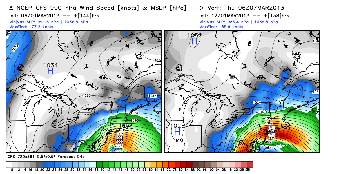
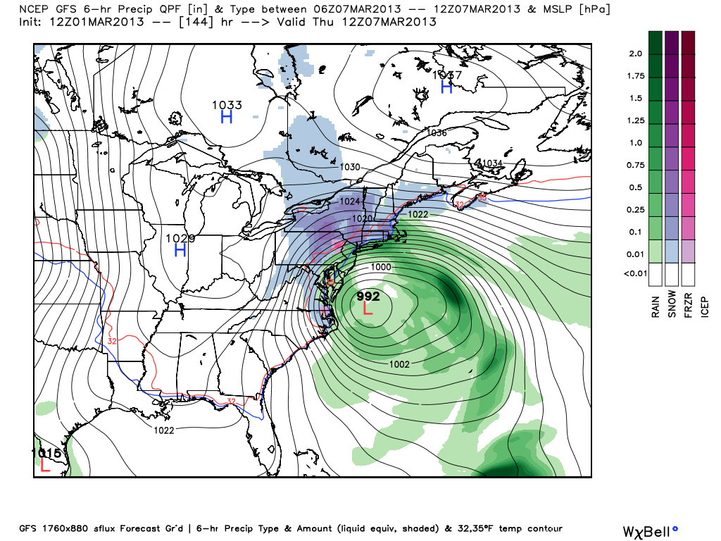
The 12Z GFS has a major storm for the Mid-Atlantic and New England. There is a limited cold air supply, and the intensity of the storm may be enough to bring in mild air off the ocean to change snow to rain near the coast, but, inland it could be a whopper of a late-winter snowstorm for a large area. Impacts for Southern New England would include heavy inland snow, heavy rain near the coast, a mix in the I-95 corridor, strong winds, coastal flooding.
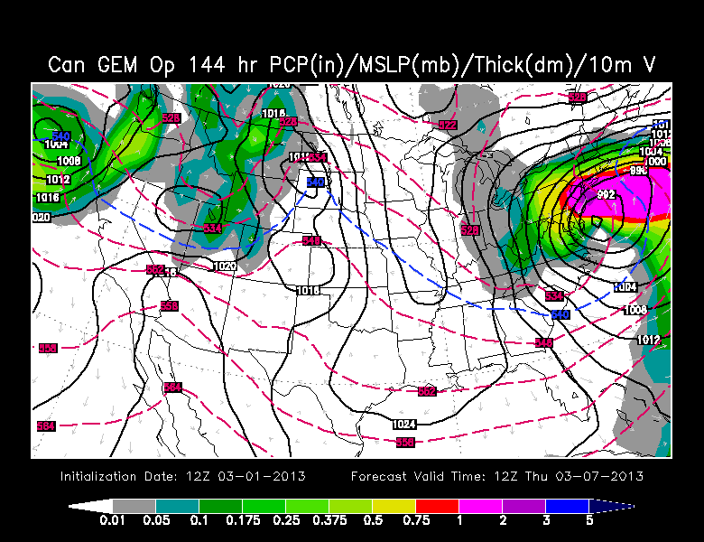
GEM (Canadian)
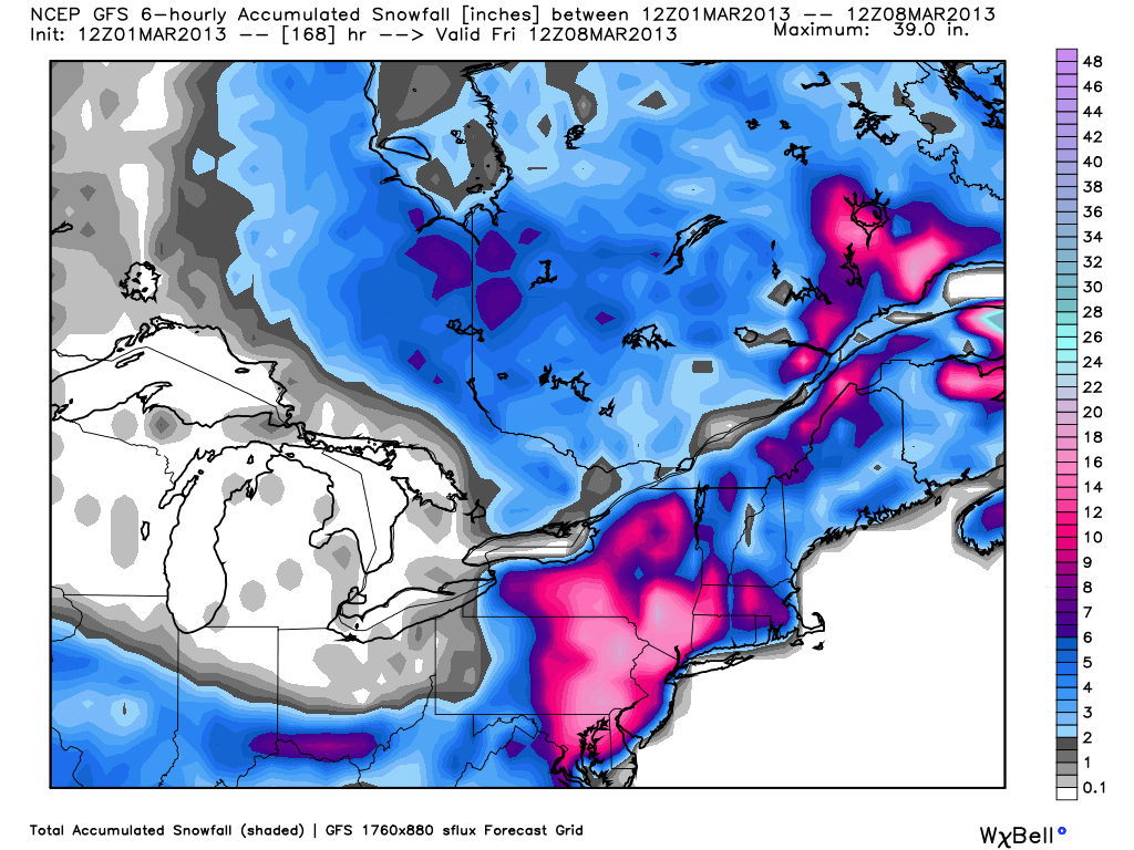
The Canadian model also has a powerful Mid-Atlantic and Northeast storm. It is similar to the 12Z GFS in bringing the storm to east of the DelMarVa Peninsula by early Thursday morning. Once again, it looks like an intense slow-mover that would batter the Mid-Atlantic and Southern New England with inland snow, coastal rain, coastal flooding and strong winds.
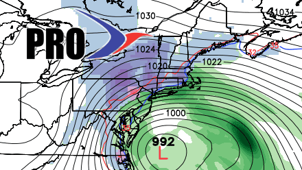
ECMWF (European)
The European has a major Mid-Atlantic storm in the middle of next week, but the track is too far south for much of an impact in Southern New England. If the ECMWF verifies, then from Philadelphia to Washington DC would see a large snowstorm (possible blizzard), and Southern New England would see breezy conditions with snow showers and flurries, primarily near the coast.

The bottom-line is there is still a long way to go with this forecast, and the potential exists for a significant Mid-Atlantic and Southern New England storm in the middle of next week. Right now, the odds of the Mid-Atlantic getting hit are higher than they are in New England.


