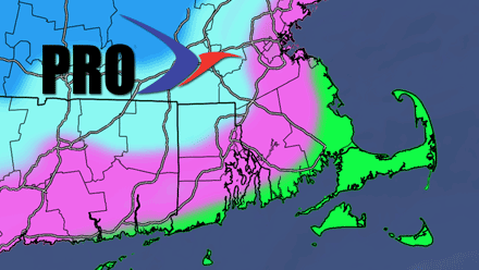
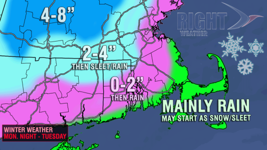
First look accumulation map Monday night into Tuesday

Spring arrives Tuesday, but Mother Nature is paying no attention to what the calendar says in Southern New England. Not only will the first few days of spring be unseasonably cool, but it looks like the first two weeks of spring could feature colder than normal weather in Southern New England. While this cool month is not unexpected (see spring outlook), it is definitely not pleasant for those of us looking for some brighter, warmer weather.
A combination of two storms moving from west to east across the country will bring a wintry mess to inland Southern New England late Monday night into Tuesday. There should be enough mild air near the coast for the storm to be mainly rain. Farther inland, in NW RI, NE CT, and Worcester County, the storm will bring several hours of wintry precipitation before a change to rain. In the middle, namely the I-95 corridor, there should be a shorter duration of snow before a change to rain. This looks like one of those “front end thumps” where moderate precipitation comes in as warmer air tries to overtake the cold air that is entrenched in New England. Odds are the cold air will hang on in Northern New England as the storm redevelops over or just south of Southern New England. This is great news for the ski resorts that have already enjoyed phenomenal conditions in the late-winter.
Any snow that falls for the coast to the I-95 corridor should be relatively inconsequential as the ground is no longer frozen and widespread icy roads are not expected. The timing of the snow/mix is not great, with As with most late and early season storms, the best chance of accumulating snow is in the higher terrain. In Southeastern New England, that means the aforementioned areas outside of I-295 in RI, in NE CT, and in Worcester County. The potential exists for 2-4″ of wet snow in NW RI and NE CT. Farther north, in Worcester County, there is the potential for 4-8″ of snow as the cold weather will be slower to erode both at the surface and aloft.


