
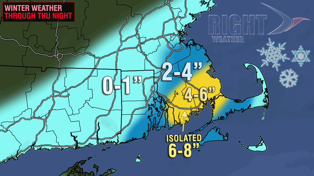
A stubborn band of moderate to heavy snow will remain parked over Southeastern Massachusetts Thursday evening. The bursts of snow feature large flakes and fast accumulations. Snowfall rates of 1″ per hour are possible through the evening. The snow should wind down by dawn Friday. There is not a lot of snow accumulation on main roads, but side roads, driveways, and sidewalks may become snow-covered. The snow is not nearly as steady/heavy in W RI and interior MA. See the updated accumulation map for the latest on what we’re expecting to be on the ground by Friday morning.
Friday will be partly cloudy, brisk, and cool. Highs will be near 40. The weekend should gradually improve. Saturday will be breezy with highs in the mid 40s. It will be partly to mostly sunny. Sunday looks bright, with less wind, and highs in the mid to upper 40s.


