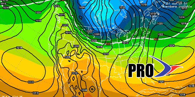
We have been on quite a run in the past couple of weeks in Southern New England. Beginning March 14, all but two days (the last two) have been at least 4° colder than normal at TF Green Airport. Overall, there is no huge change in the weather pattern this week, but there are signs that the current pattern will be breaking down in the next few weeks. The persistent trough near the Eastern Seaboard may weaken by this weekend, and the result will be typical early-spring weather for the first week of April – including the showers.
- Mainly dry and cool Tuesday to Saturday
- Easter Sunday looks a bit milder – in the 50s
- While it will be milder next week, it also looks like there could be a couple of rain events
- Pattern gets milder in early-April, but it does not look extremely mild – at least through April 10


