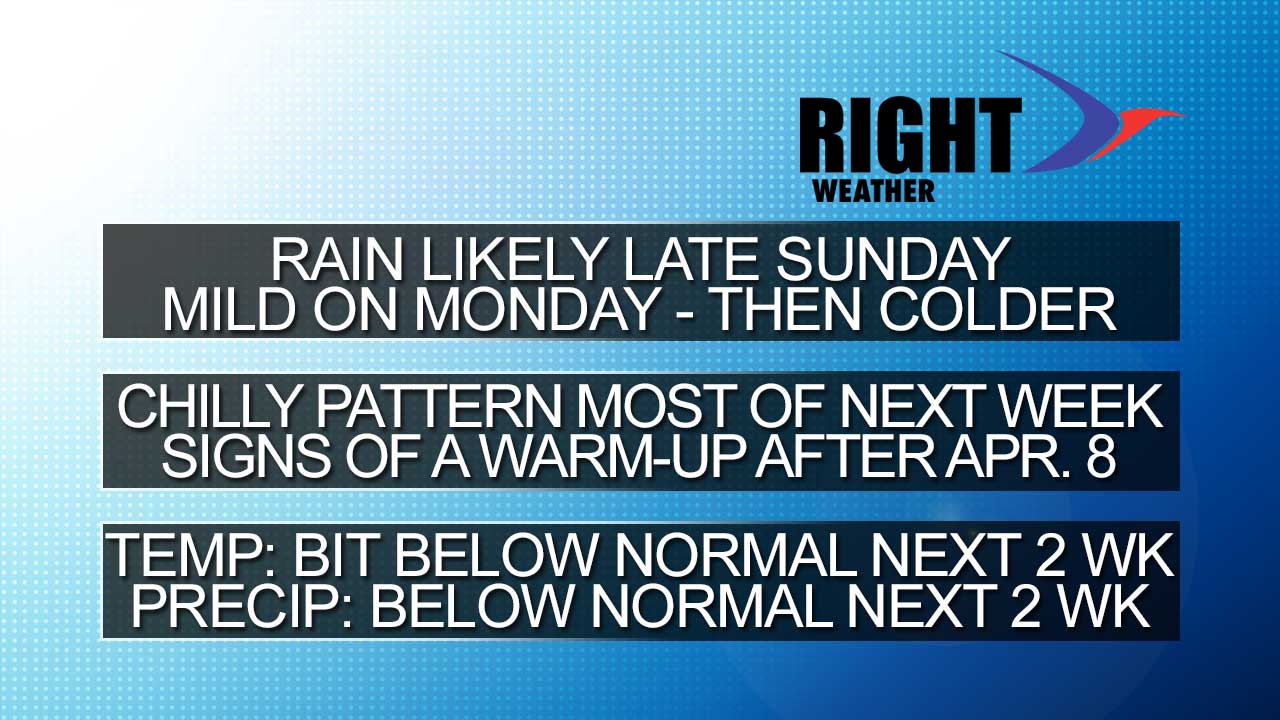
The last few days of March should be near or warmer than normal in Southeastern New England. So, March will go out like a lamb. The first day of April will feature showers (before dawn) and spring-like warmth (maybe 60). Unfortunately, after the mild Monday, another shot of unseasonably cool air will move in for the mid to late week. It will likely be mainly dry Tuesday-Friday, but the temperature will struggle to get out of the 40s.
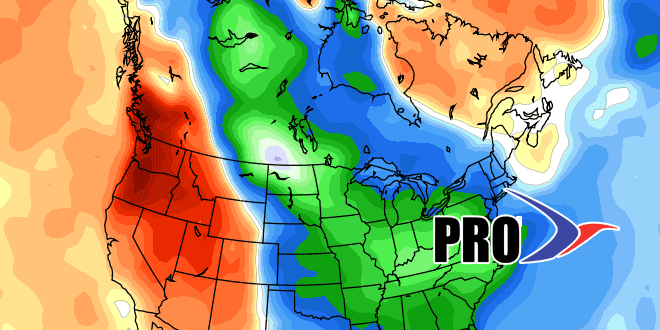
Looking ahead to next weekend, there is the possibility of some unsettled weather along the Eastern Seaboard. In a worst-case scenario, a chilly storm moves north and brings rain to Southern New England and snow to the mountains of Northern New England for the first weekend of April. Farther down the road, there are signs that the weather pattern will be shifting to warmer weather in the Northeast. The timing of the potential warm-up is in the second week of April.