We have been advertising the potential for a big midweek storm in the Mid-Atlantic and Northeast for several days. While the potential for a high-impact storm still exists, the details of the forecast are, unfortunately, still vague. The strong storm which produced blizzard conditions in Western Canada this weekend is heading for the Midwest Tuesday, and the Mid-Atlantic Tuesday night through Wednesday. If the storm is to have a big impact in Southern New England, it would occur Wednesday night through Thursday.
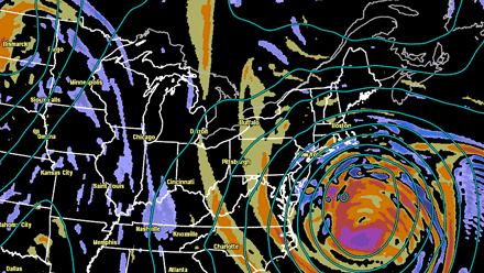
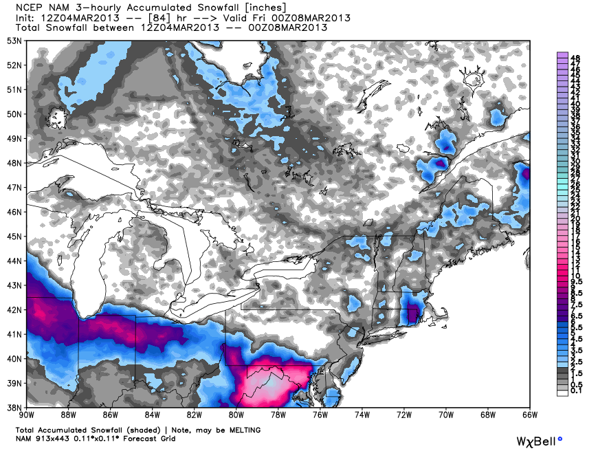
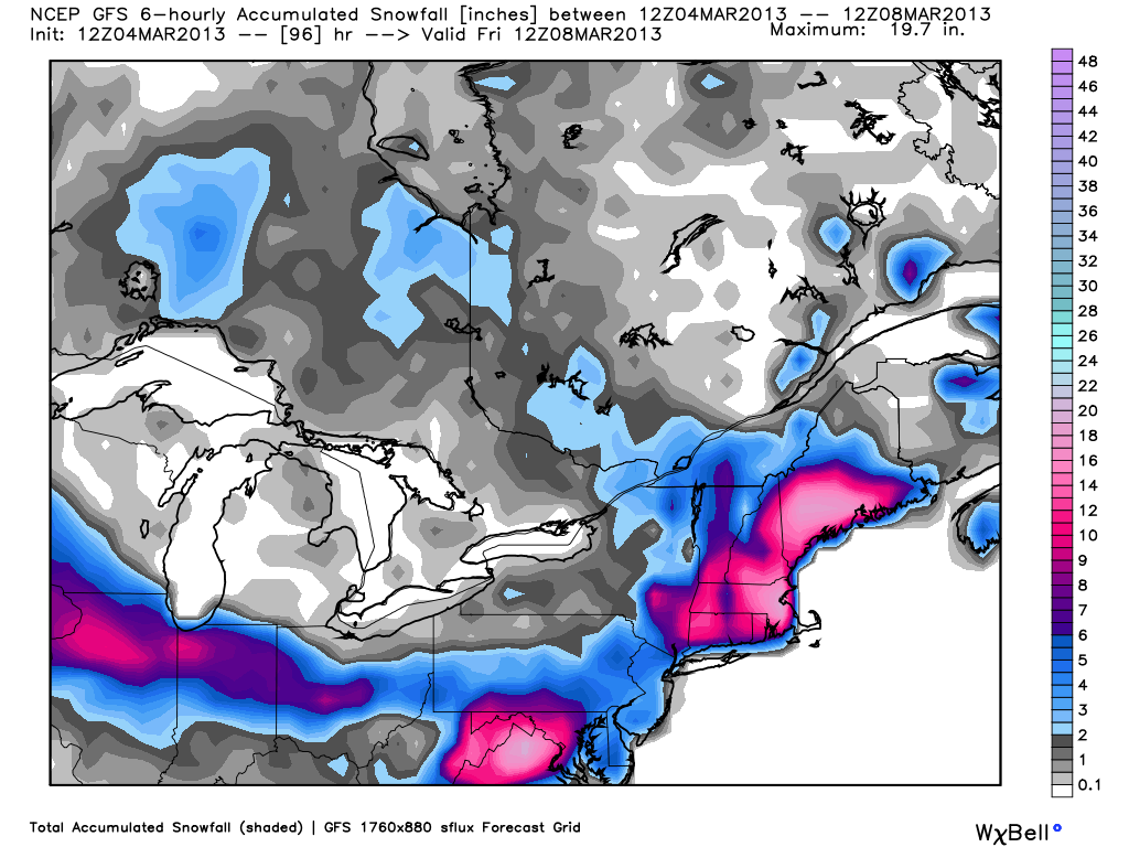
A high stakes forecast that teeters on the edge between near-blizzard conditions and low impact for some of the biggest metropolitan areas east of the Mississippi River makes this especially challenging for meteorologists. From Chicago to Washington DC to Philadelphia to New York City to Boston the forecast is a very close call between a large winter storm and something a lot less impressive. Notice the computer model graphics below that indicate the potential swath of snow that follows the northern edge of the storm’s track. There is not a ton of agreement among these models in some highly populated areas, particularly Washington DC, and Southern New England.
It’s most likely that Chicago will pick up a plowable snow. The stakes are very high in Washington DC which could be anywhere from no snow to a foot or more in some of the dire scenarios. Most computer models have a glancing blow or less for Philadelphia and New York City. Southern New England sits somewhere between a minimal impact and a moderate amount of snow with very strong winds.

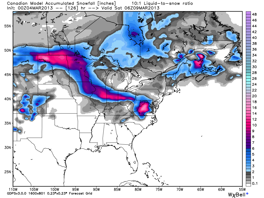
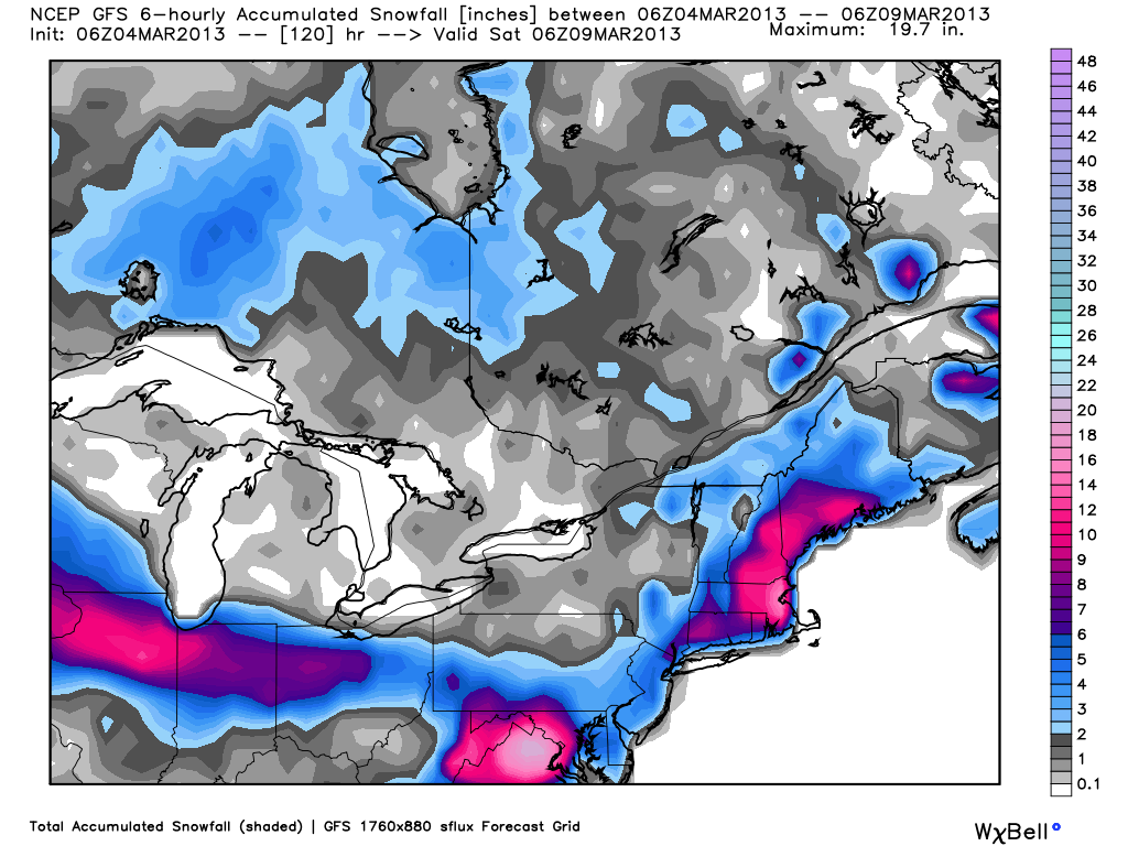
So, this all begs the question “what will the impact be in Southern New England?”. Unfortunately, there is no solid answer to that yet. While the American computer models are leaning toward accumulating snow and powerful coastal winds Wednesday night through Thursday, the highly touted European model has little more than a gusty breeze and a few snow showers. Monday afternoon’s European computer model run will be critical in, hopefully, improving the confidence level of the forecast. Our feeling is that it will trend closer to Southern New England, meaning another accumulating snowfall is in the cards for most of RI, MA, and CT before the end of the workweek.


