Southern New England will get a break from winter weather this weekend. There will be a decent amount of sunshine both Saturday and Sunday, and, although it will be a bit cool for late-March, it will also be warmer than it has been lately. There will be a gusty breeze on Saturday. The day will start with temperatures in the 20s. The afternoon high should be in the mid 40s. Overall, Sunday should be a better day, with plenty of sunshine, a light breeze and highs in the mid to upper 40s.
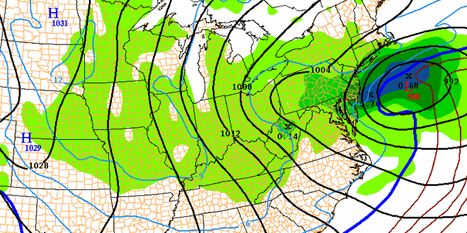
A storm will move from the Plains to the Mid-Atlantic by late in the weekend. That storm heads into the Atlantic Ocean south of Southern New England early next week. The jury is still out on its impact in RI, MA, and CT. Right now, there is about a 50/50 chance that another round of snow will develop in Southern New England Monday afternoon into Tuesday morning. If there is any snow on Monday, it will most likely not accumulate until after sunset. The best chance of accumulating snow from this system is Monday night.

The weather pattern looks quiet following the early-week storm threat. It will be seasonably cool with highs in the mid to upper 40s Tuesday through Thursday. Once again, the predominant wind direction on the dry days will be out of the west-northwest as the same weather pattern that has been in place for most of this month persists.


