Southern New England was already experiencing fringe effects Wednesday from the powerful Nor’easter that will have a more direct impact Wednesday night through Friday. The storm is expected to bring periods of heavy snow and rain, strong winds, and coastal flooding through midday Friday. The main threats from the storm include wet, heavy snow that downs trees and power lines leading to power outages, wind gusts over 50 mph that also cause damage, severe beach erosion due to a storm surge and large waves for several high tide cycles, and the potential for some street, river, and stream flooding in areas that receive heavy rain.
The long duration of the storm means that the impacts will be spread out over a couple of days, and, in some areas, the precipitation could change back and forth from snow to rain several times before ending.
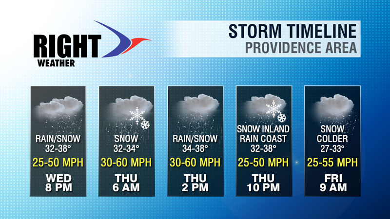
The graphic gives you a general idea of the conditions that are expected during the storm. A few inches of snow are possible Wednesday night before changing to a mix or rain during the day on Thursday. Even if the precipitation remains all snow during the day Wednesday, it will not accumulate quickly because of the high March sun angle and temperatures in the 30s. A change back to heavy, wet snow is possible Thursday night into Friday morning. The highest odds of seeing of accumulating snow Thursday night is away from the coast. The precipitation should wind down by midday Friday, and the wind will finally relax on Saturday.