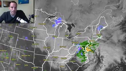
A large and slow-moving late-winter Nor’easter will have a big impact in Southern New England for the remainder of the workweek. The impacts will be varied by location and type, ranging from heavy, wet snow to heavy rain, strong winds, and coastal flooding. Right Weather Meteorologist Fred Campagna has an update on the storm’s development and expected effects on Southern New England.
- Nor’easter storm timeline
- National Weather Service issues Coastal Flood Warning
- TV station snow forecast roundup
- Live Blog: Wednesday, March 6, 2013 (Right Weather Pro)


