The mildest weather of 2013 in Southern New England is on the doorstep. It will be an unseasonably warm start to the week with highs in the 60s inland and mid to upper 50s near the coast on Monday. There will be a blend of clouds and sun, and a west to southwesterly 10-20 mph breeze.
A disturbance will move through Monday night into early Tuesday opening the doors to even warmer weather on Tuesday. The high temperature should be near 70 degrees inland on Tuesday. It will be in the 60s at the coast because the wind will not be directly off the ocean. There is the chance of some early-morning showers, with partly sunny skies in the afternoon.
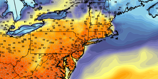
There will be a sharp dividing line between warm and relatively cool weather in the middle to late part of the workweek. Right now, it looks like Southern New England will still be on the mild side on Wednesday. If the front is far enough north, then highs will be in the 70s inland and 60s near the coast.
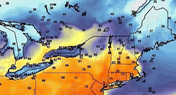
There is a better chance of showers on Thursday with highs in the 50s to low 60s. The worst day of the workweek will likely be Friday. A storm system will move through with steady rain sometime between Friday and early Saturday. Highs will be in the 40s to low 50s. At this point, next weekend isn’t looking bad. It will be seasonably cool and dry, with highs in the 50s.


