Saturday looks like a bright, windy, and seasonably cool day with highs in the upper 40s to low 50s. There will be a plenty of sunshine, and a gusty 15-30 mph northwest breeze that diminishes in the afternoon. A Red Flag Warning is in effect for part of New England due to the combination of very dry and windy weather. Clouds will gradually increase Saturday night. It will be cool in the evening, with temperatures falling through the 30s before leveling off after midnight. There will be a few more clouds on Sunday, but it still looks pretty nice. The wind will shift to the south-southwest, allowing the temperature to rise into the mid 50s inland. The onshore breeze cools the coast significantly at this time of the year, so expect afternoon temps in the upper 40s to low 50s.
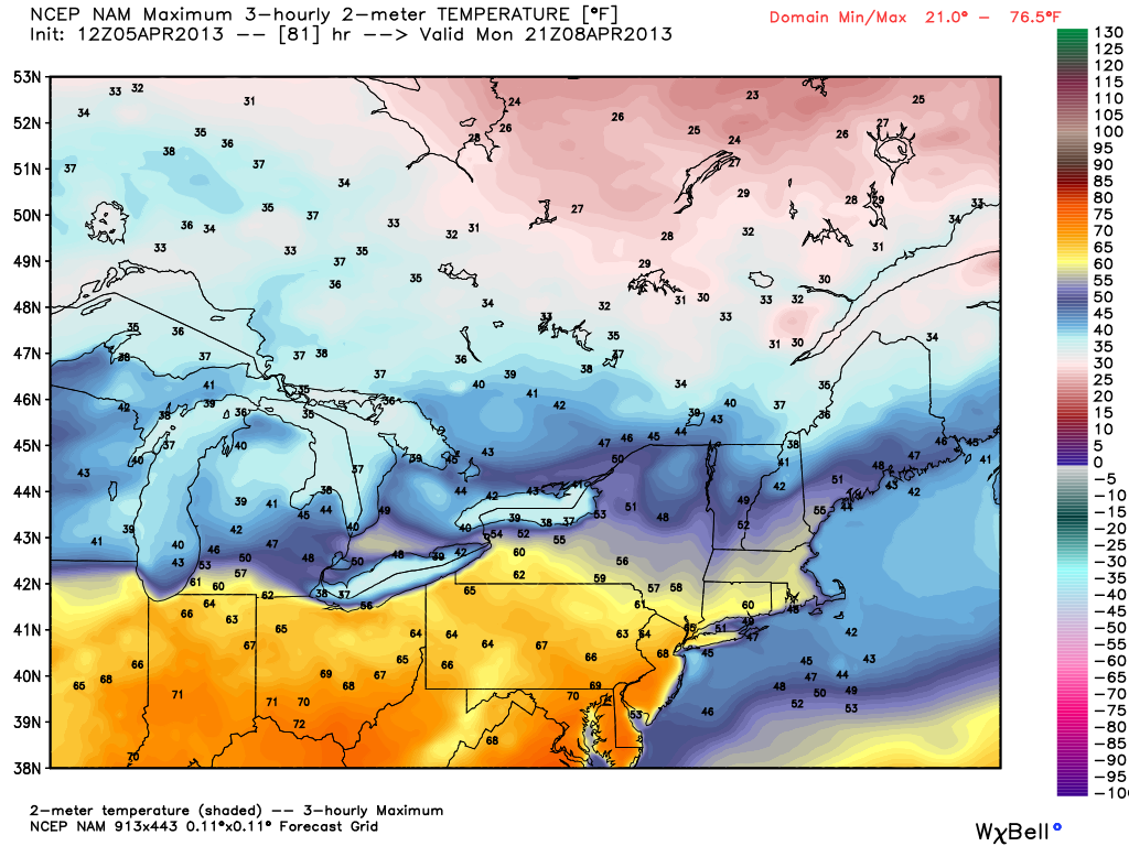
Monday looks like a phenomenal day. It will be mild everywhere, with the warmest conditions away from the coast. There should be plenty of afternoon sunshine. Highs will make a run at 70 inland, and it will be in the mid to upper 50s near the coast. By late in the day, there could be a 20° difference between inland and coastal locations due to the onshore breeze.
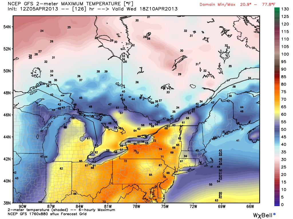
There is potential for Tuesday to be even warmer, but it will depend on the timing of a cold front. At this point, the forecast is for a high near 70 inland, but it could be considerably cooler if the front moves through sooner than anticipated and shifts the wind to the north-northeast. A slow-moving weather system will likely bring showers to the Northeast by late next week, but the timing of that system is very much in question, leaving the forecast for Thursday and Friday unclear.


