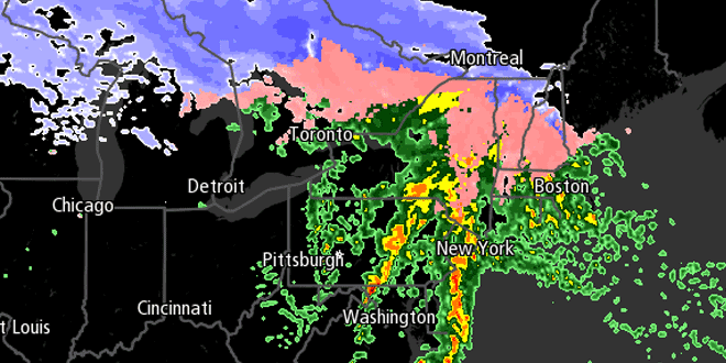
The weather has been getting gradually cooler after peaking in the mid to upper 70s on Tuesday afternoon. Wednesday was in the 60s, Thursday in the low 50s, and Friday will be even cooler. In addition, there will be steady rain for most of the day.
Steady should begin between 8-11 am in Southern New England. The temperature will hover in the upper 30s to mid 40s throughout the day. The heaviest downpours are likely during the afternoon, with the rain tapering off by late in the evening. Rainfall totals should be between 0.75-1.25″ for all of Southern New England. If you’re traveling west on the MA Pike tomorrow, you may encounter some sleet and snow in the higher terrain of Worcester County and in the Berkshires.
Clouds will be stubborn into Saturday morning as the storm moves away. Look for increasing sunshine through the midday hours, with highs in the mid to upper 50s. There will be a westerly breeze between 10-20 mph. Clouds will return Saturday night as a weak weather system moves through Northern New England. A few sprinkles are possible with lows in the low to mid 40s.
Sunday should be decent, but likely not as mild as Saturday. Highs will be in the low to mid 50s with partly sunny skies. The weather will stay quiet early next week. A gradual warming trend is possible through the midweek. Check out the 10 Day Forecast on rightweather.net for the latest.


