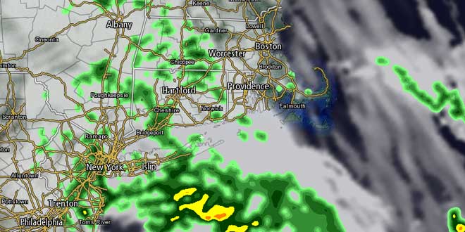
Saturday was a typical mid-spring day in Southern New England. High temperatures were in the 70s inland and 60s near the coast with an onshore breeze. There were more clouds in the afternoon, but showers stayed well away from CT, RI, and MA. The weather should stay dry through most, if not all, of Sunday. It will be cooler due to more clouds and another onshore breeze. Highs will be in the mid 60s inland, and closer to 60 at the coast. There may be a few showers in the afternoon or evening if the boundary that was near New York City on Saturday moves a bit farther northeast than forecast.
The warm front, and corresponding area of showers, will move into Southern New England Sunday night into Monday. The position of the boundary between cool air to the north and warm air to the south will be critical in determining what type of weather Southern New England sees next week. Right now, it looks like the front may move far enough north on Monday afternoon to allow the temperature to reach the upper 60s to low 70s, with the shower threat diminishing.
The front will waver north and south Tuesday through Thursday, and the forecast is for some showers, and, at this point, it is impossible to pin down exactly when they’ll arrive. The temperature will be in the low to mid 50s at night, and in the 60s to low 70s during the day – unless the front gets well north of SNE, in which case the temperature would jump to near 80 inland.
Late next week, the system will finally move east, bringing a cold front with showers and thunderstorms Thursday night into Friday. The early outlook for Memorial Day weekend is for dry, seasonably cool weather. It’s not a very high-confidence forecast given the uncertainties we are expecting in the near-term.


