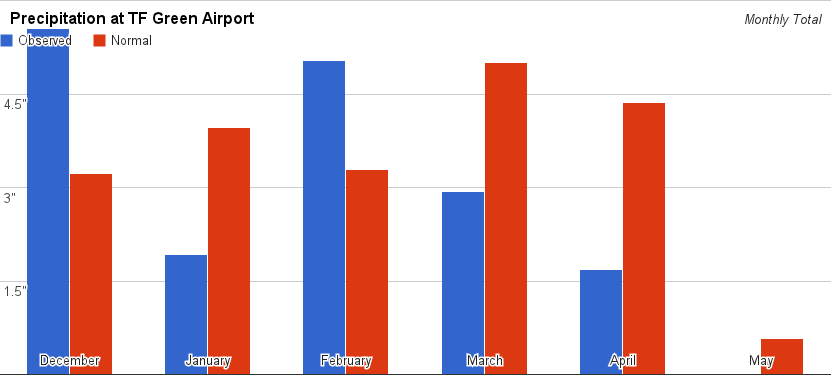
Most of Southern New England has observed abnormally dry conditions this spring. All but Southeastern Massachusetts have had a considerable rainfall deficit since early-March. As of May 6, the four major climatological sites in Southern New England (Boston, Providence, Hartford, Worcester) have all gone at least 11 days since the last measurable rain. Here are some numbers surrounding the recent dry stretch in the Providence area. All stats are based off of data from TF Green Airport.
- There has been 34% of the normal rain since April 1 (1.68″/4.93″)
- There has been 46% of the normal rain since March 1 (4.62″/9.94″)
- There has been 68% of the normal rain since January 1 (11.58″/17.09″)
- There was a mini-drought last spring. Between February 1 and April 20, there was 27% of the normal amount of rain.
It looks like the dry stretch will end with some rain Wednesday-Thursday, followed by a potentially unsettled pattern that lasts through the weekend. It’s unclear if there will be a lot of steady rain, but the bone-dry pattern that Southern New England has been in for the past couple of weeks is breaking down.


