The Memorial Day weekend went south pretty quickly with the formation of a storm along the front that will be slowly moving east through the Northeast on Friday. The wind swings around to the north and temperatures tumble into the 40s and 50s Saturday into Sunday. Ouch! That is rough for late-May and the “unofficial start of summer”. The weather will turn the corner pretty quickly early next week. Memorial Day should be a decent, but not warm, day, with highs in the 60s. It will get seasonably warm through the middle of next week.
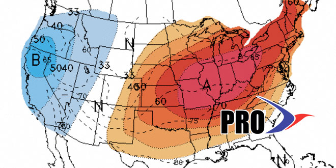
There is a very high likelihood of a big warm-up from the Ohio Valley to the Mid-Atlantic by late next workweek. It’s possible the very warm weather makes it all the way into New England. We’ll have to keep an eye on the weather systems that are moving along the northern periphery of the warm weather. It’s possible they’ll come close enough to shift the wind to a cooler direction in New England. For the first week of June, it’s possible SNE will get a few warm days followed by a couple of seasonable or cool days, then the warm weather tries to return. It may stay unseasonably warm from the Midwest to Mid-Atlantic during that same timeframe.
Have a great weekend – in spite of the weather!


