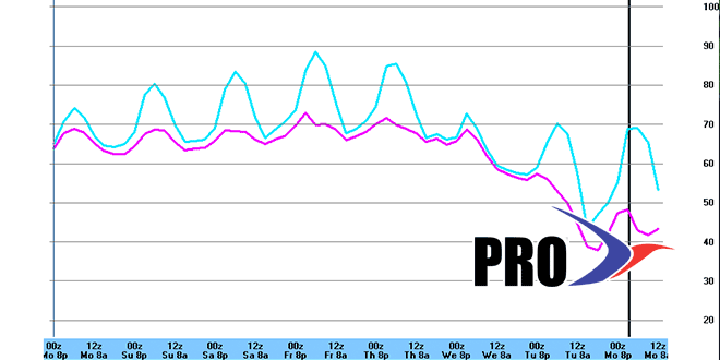
Long Range Forecast – May 27

It was a wacky Memorial Day weekend in the Northeast. Up to three feet of snow fell in the Northern Adirondack Mountains, and, yet, the weekend ended with highs in the 70s under brilliant sunshine on Monday afternoon. This time of the year, the weather can go from bad to good in a hurry. Some of the same areas that saw snow early in the weekend will see highs flirting with 90° by the end of the workweek.
Wednesday is the transition day, with showers and thunderstorms likely – especially in the morning. There could be some real gully washers as the warm front moves through. There is still a decent rainfall deficit in most of Southern New England, so the rain will be welcome. With any luck, the rain will end by mid-afternoon Wednesday. The real warm-up will not be noticed until Thursday afternoon. Highs in the mid to upper 80s inland are likely from Thursday through Saturday – and maybe Sunday. A southwesterly afternoon breeze should keep the coast 10-15° cooler each day. It’s possible some inland locations could see an early-season heat wave with three straight 90° days.
All indications are that the heat will not be sticking around into next week. A cold front should end the warm stretch late Sunday or Monday. The pattern looks somewhat unsettled next week, with an inverted trough along the Eastern Seaboard. The exact position of the trough is in question, and its the difference between a rather rainy stretch and a stretch that is mainly dry and seasonable. The moisture riding into the inverted trough will come from the Gulf of Mexico and Caribbean where there is the potential for the first tropical system of the season to form just as hurricane season begins on June 1.


