Clouds were stubborn on Wednesday in Southeastern New England as a warm front slowly moved back north from the Mid-Atlantic. A Severe Thunderstorm Watch was posted for Northern Connecticut and Massachusetts from Worcester County west until 10 pm. Thunderstorms, some of which may be severe, are possible through mid to late evening in those areas. There is a much lower probability of rain in RI and SE MA Wednesday evening.
Clouds will hang around into Thursday morning. There will be some patchy fog, especially near the coast. It will be an unseasonably mild and muggy night, with lows in the upper 50s to low 60s – borderline air conditioner weather! There will not be too much sunshine Thursday, either. Highs will be in the low to mid 70s inland, and upper 60s to low 70s near the coast with a southwesterly breeze.

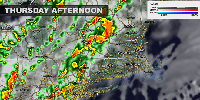
The same storm that brought tornadoes to the Midwest will finally reach the Northeast on Thursday. The odds of showers increase from west to east by late in the day and Thursday evening. It’s quite possible there will not be any appreciable rain in Southeastern New England until after the sun sets. Showers and thunderstorms are likely Thursday night into Friday as the front slowly moves east and a storm develops along it. Highs on Friday will be in the low to mid 60s with occasional rain. Unfortunately, it looks like the storm will linger through part of the Memorial Day weekend. Click here for the latest on that part of the forecast: http://bit.ly/rw-memday


