The storm that brought heavy rain Monday night and Tuesday has moved into the Canadian Maritimes but is still influencing the weather in Southern New England. The intensifying storm is responsible for some cloud cover and gusty northwesterly winds. That storm will very slowly move east Wednesday night as the next weather maker approaches the Northeastern United States. Look for clear to partly cloudy skies Wednesday night. Lows will be in the low to mid 50s with a diminishing wind.
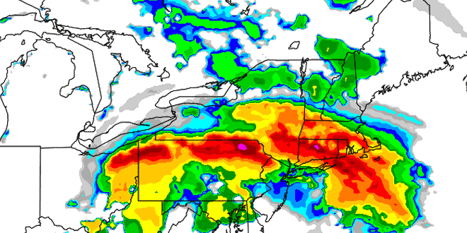
The weather will go downhill on Thursday. An unusually strong mid-June storm will peel through the Ohio Valley and cut just south of Southern New England Thursday night into Friday. Rain will break out ahead of the system during the day Thursday. Moderate to heavy rain will spread from west to east, likely reaching most of CT and W MA in the morning, before overspreading RI and SE MA during the afternoon. A Flood Watch is in effect for most of Southern New England from Thursday into Saturday morning. This June is already the fourth wettest on record in the Providence area dating back to 1905.
The heaviest rain will most likely end by Friday morning, but occasional showers are possible during the day. It will be unseasonably cool, with highs only in the 50s and a gusty north-northeasterly wind. The wind may gust over 40 mph near the coast and on the islands between Thursday afternoon and Friday afternoon. Final rain totals should be between 1-3″ in most of Southern New England. The areas that see more than 2″ of rain could see widespread street, river, and stream flooding. At this point, it is difficult to say exactly where the heaviest rain will be. The favored areas for heavy rain are in western and coastal Connecticut.
The storm will not have a big impact on the Father’s Day weekend, other than the potential for some residual flooding problems. It will move away quickly Friday night, and Saturday and Sunday both look nice and seasonable. Highs will be in the 70s under mostly sunny skies.
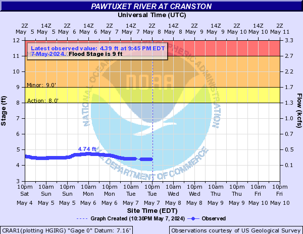
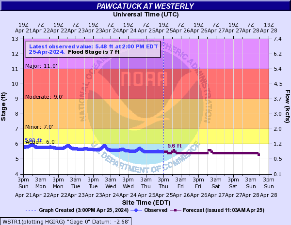
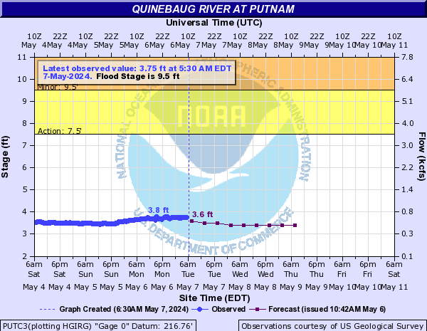
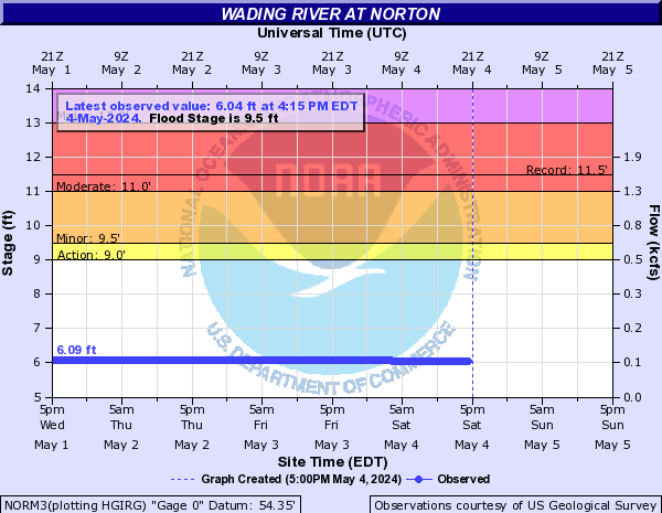
Updated Southeastern New England River Gauges